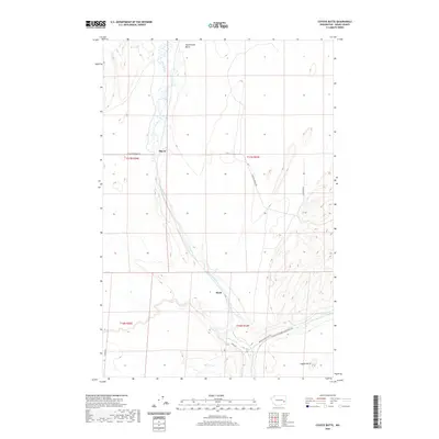
2020 Map of Coyote Butte
USGS Topo · Published 2020About this map
Cow Creek carves a distinct path through the heart of this Adams County landscape, tracing a serpentine route toward the settlement of Mack. This modern survey illustrates the rural connectivity of the region, where legacy rail corridors have transitioned into recreational infrastructure, most notably the Columbia Plateau State Park Trail which parallels the creek bed. The terrain is defined by prominent basalt features typical of the Channeled Scablands, including Coyote Butte in the southeast and Terksaleeze Butte to the north.
Find a feature on this map
17 named features on this map. Tap any name to fly to it.
Don’t see what you’re looking for? This feature index may not catch every label — zoom into the map to look around manually.
Map Details
Editions of this 2020 Coyote Butte Map
This is the sole edition of this map. No revisions or reprints were ever made.
Other maps of this area

1923 · Washtucna
USGS Topo · 1:62,500

1925 · Washtucna
USGS Topo · 1:62,500

1950 · Benge
USGS Topo · 1:62,500

1952 · Benge
USGS Topo · 1:62,500

1953 · Walla Walla
USGS Topo · 1:250,000

1953 · Ritzville
USGS Topo · 1:250,000

1958 · Walla Walla
USGS Topo · 1:250,000

1959 · Ritzville
USGS Topo · 1:250,000

1964 · Macall
USGS Topo · 1:24,000

1964 · Marengo
USGS Topo · 1:24,000