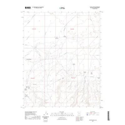
2023 Map of Coyote Canyon
USGS Topo · Published 2023About this map
Brimhall-Nizhoni sits as a primary settlement node in this high-desert landscape of McKinley County, where the terrain is defined by a complex network of seasonal drainages and geological landmarks. The map illustrates a transition from the winding course of Coyote Wash and its tributaries, such as Figueredo Wash and Dye Brush Wash, to the dramatic vertical relief of the Chuska Mountains foothills. High points like Dzil Nda Kai Mountain and Little Ear Mountain overlook a series of deeply etched canyons, including Big Spring Canyon and Wild Berry Canyon.
Find a feature on this map
28 named features on this map. Tap any name to fly to it.
Don’t see what you’re looking for? This feature index may not catch every label — zoom into the map to look around manually.
Map Details
Editions of this 2023 Coyote Canyon Map
This is the sole edition of this map. No revisions or reprints were ever made.
Other maps of this area

1886 · Wingate
USGS Topo · 1:250,000

1892 · Wingate
USGS Topo · 1:250,000

1954 · Gallup
USGS Topo · 1:250,000

1958 · Gallup
USGS Topo · 1:250,000

1959 · Gallup
USGS Topo · 1:250,000

1962 · Gallup
USGS Topo · 1:250,000

1963 · Big Rock Hill
USGS Topo · 1:24,000
1963 · Hard Ground Flats
USGS Topo · 1:24,000
1963 · Oak Spring
USGS Topo · 1:24,000

1967 · Gallup
USGS Topo · 1:250,000