
1963 Map of Big Rock Hill
USGS Topo · Published 1967About this map
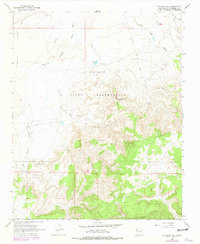
Navajo Indian Reservation lands in McKinley County define this 1960s landscape, where traditional ranching and early mining interests intersect across high-desert terrain. The map details the area around Sheep Spring, a localized hub featuring several wells and a topographic prominence known as Sheep Spring Hill. To the south, Big Rock Hill rises sharply above the Tohatchi Flats, marked by a network of seasonal watercourses like Figueredo Wash and Dye Brush Wash.
Find a feature on this map
25 named features on this map. Tap any name to fly to it.
Don’t see what you’re looking for? This feature index may not catch every label — zoom into the map to look around manually.
Map Details
Editions of this 1963 Big Rock Hill Map
2 editions found
Other maps of this area

1886 · Wingate
USGS Topo · 1:250,000

1892 · Wingate
USGS Topo · 1:250,000

1954 · Gallup
USGS Topo · 1:250,000

1955 · Tohatchi
USGS Topo · 1:62,500

1958 · Gallup
USGS Topo · 1:250,000

1959 · Gallup
USGS Topo · 1:250,000

1962 · Gallup
USGS Topo · 1:250,000

1963 · Twin Lakes
USGS Topo · 1:24,000

1963 · Gallup West
USGS Topo · 1:24,000
1963 · Church Rock
USGS Topo · 1:24,000