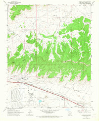
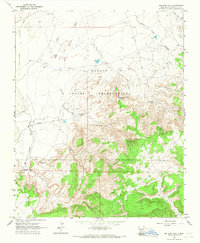
1963 Map of Church Rock
USGS Topo · Published 1967About this map
Springstead Trading Post sits as a lonely outpost on the high desert flats of this 1963 survey, a landscape defined by the towering formations of White Rock Mesa and the spire of Navajo Church. The northern reaches are carved by Hard Ground Canyon, while the southern half of the map is dominated by the sprawling infrastructure of the Fort Wingate Army Depot. The Atchison Topeka and Santa Fe railroad tracks cut a precise horizontal path through the valley, paralleling the Puerco River and the settlement of Church Rock. Resource extraction is evident through several Gravel Pits and the Church Rock Mine, suggesting a busy industrial corridor. Cultural landmarks like Kit Carsons Cave and the Old Boundary Fort Wingate Military Reservation offer significant reference points for local historians and genealogists tracing early New Mexico land use.
Find a feature on this map
28 named features on this map. Tap any name to fly to it.
Don’t see what you’re looking for? This feature index may not catch every label — zoom into the map to look around manually.
Map Details
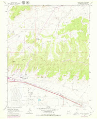
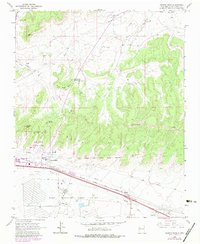
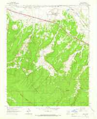
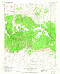
Editions of this 1963 Church Rock Map
3 editions found
Other maps of this area

1886 · Wingate
USGS Topo · 1:250,000

1892 · Wingate
USGS Topo · 1:250,000

1954 · Gallup
USGS Topo · 1:250,000

1958 · Gallup
USGS Topo · 1:250,000

1959 · Gallup
USGS Topo · 1:250,000

1962 · Gallup
USGS Topo · 1:250,000
1962 · Ciniza
USGS Topo · 1:24,000
1963 · Big Rock Hill
USGS Topo · 1:24,000
1963 · Pinedale
USGS Topo · 1:24,000
1963 · Bread Springs
USGS Topo · 1:24,000
Featured Places
- Gallup, NM
- Eastern Navajo Agency, NM
- Navajo Wingate Village, Eastern Navajo Agency
- Church Rock, Eastern Navajo Agency
- Wingate, Eastern Navajo Agency