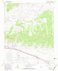
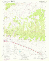
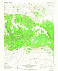
1963 Map of Church Rock
USGS Topo · Published 1983About this map
The Fort Wingate Army Depot dominates the southern landscape of this New Mexico quadrangle, where military infrastructure meets the high desert floor along the Puerco River. Established corridors of industry and transit define the valley, marked by the heavy-duty rails of the Atchison Topeka and Santa Fe railroad and the roadside clusters of McCune and Perea. To the north, the terrain transitions into striking geological formations such as White Rock Mesa and the prominent spires of Navajo Church. Local commerce and resource extraction are evident through the Springstead Trading Post and the Church Rock Mine, while the inclusion of Red Rock State Park and Kit Carsons Cave highlights the region's long-standing status as a landmark destination. The map provides a detailed view of the Fort Wingate Military Reservation boundary and its interface with the surrounding Navajo lands and the growing community of Church Rock.
Find a feature on this map
34 named features on this map. Tap any name to fly to it.
Don’t see what you’re looking for? This feature index may not catch every label — zoom into the map to look around manually.
Map Details
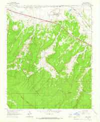
Editions of this 1963 Church Rock Map
3 editions found
Other maps of this area

1886 · Wingate
USGS Topo · 1:250,000

1892 · Wingate
USGS Topo · 1:250,000

1954 · Gallup
USGS Topo · 1:250,000

1958 · Gallup
USGS Topo · 1:250,000

1959 · Gallup
USGS Topo · 1:250,000

1962 · Gallup
USGS Topo · 1:250,000
1962 · Ciniza
USGS Topo · 1:24,000
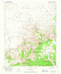
1963 · Big Rock Hill
USGS Topo · 1:24,000
1963 · Pinedale
USGS Topo · 1:24,000
1963 · Church Rock
USGS Topo · 1:24,000
Featured Places
- Gallup, NM
- Eastern Navajo Agency, NM
- Navajo Wingate Village, Eastern Navajo Agency
- Church Rock, Eastern Navajo Agency
- Wingate, Eastern Navajo Agency