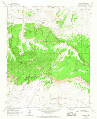
1963 Map of Pinedale
USGS Topo · Published 1967About this map
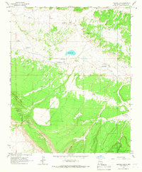
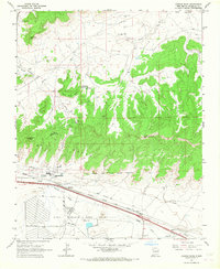
The high desert landscape of McKinley County is defined here by the rugged presence of Fallen Timber Ridge and the Old Boundary Fort Wingate Military Reservation, which cuts a definitive line across the southern terrain. This 1963 survey captures the essential community infrastructure of Pinedale, featuring a Chapter House, Sewage Disposal plant, and the Indian Sch, reflecting the structured development of the area at mid-century.
Find a feature on this map
18 named features on this map. Tap any name to fly to it.
Don’t see what you’re looking for? This feature index may not catch every label — zoom into the map to look around manually.
Map Details
Editions of this 1963 Pinedale Map
2 editions found
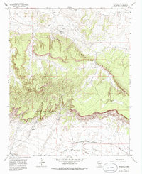
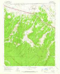
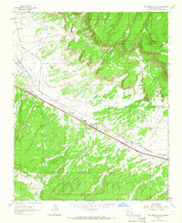
Other maps of this area

1886 · Wingate
USGS Topo · 1:250,000

1892 · Wingate
USGS Topo · 1:250,000

1954 · Gallup
USGS Topo · 1:250,000

1958 · Gallup
USGS Topo · 1:250,000

1959 · Gallup
USGS Topo · 1:250,000

1962 · Gallup
USGS Topo · 1:250,000
1962 · Ciniza
USGS Topo · 1:24,000
1962 · Continental Divide
USGS Topo · 1:24,000
1963 · Mariano Lake
USGS Topo · 1:24,000
1963 · Church Rock
USGS Topo · 1:24,000
Featured Places
- Eastern Navajo Agency, NM
- Iyanbito, Eastern Navajo Agency
- Pinedale, Eastern Navajo Agency
- McKinley County, NM
- United States