1963 Map of Pinedale
USGS Topo · Published 1986About this map
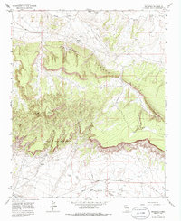
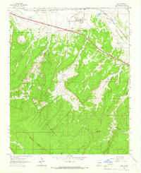
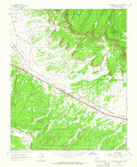
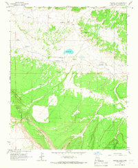
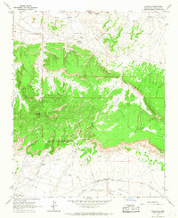
Pinedale and the surrounding Navajo Nation landscape are defined by the dramatic escarpment of Fallen Timber Ridge and the winding course of the Puerco River. In the early 1960s, this area of McKinley County reflects a combination of indigenous community life and strategic infrastructure. The settlement at Pinedale includes a Chapter House, a Sewage Disposal facility, and an Indian Sch, indicating the civic and educational hub of the district. To the south, the village of Iyanbito sits near the Atchison Topeka and Santa Fe railroad, which parallels the South Fork Puerco River.
Find a feature on this map
19 named features on this map. Tap any name to fly to it.
Don’t see what you’re looking for? This feature index may not catch every label — zoom into the map to look around manually.
Map Details
Editions of this 1963 Pinedale Map
2 editions found
Other maps of this area

1886 · Wingate
USGS Topo · 1:250,000

1892 · Wingate
USGS Topo · 1:250,000

1954 · Gallup
USGS Topo · 1:250,000

1958 · Gallup
USGS Topo · 1:250,000

1959 · Gallup
USGS Topo · 1:250,000

1962 · Gallup
USGS Topo · 1:250,000
1962 · Ciniza
USGS Topo · 1:24,000
1962 · Continental Divide
USGS Topo · 1:24,000
1963 · Mariano Lake
USGS Topo · 1:24,000
1963 · Pinedale
USGS Topo · 1:24,000
Featured Places
- Eastern Navajo Agency, NM
- Iyanbito, Eastern Navajo Agency
- Pinedale, Eastern Navajo Agency
- McKinley County, NM
- United States