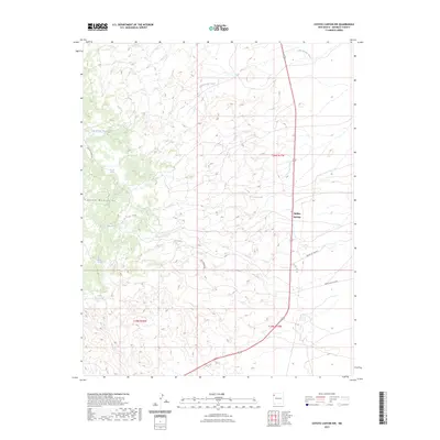
2023 Map of Coyote Canyon NW
USGS Topo · Published 2023About this map
The eastern slopes of the Chuska Mountains dominate this high-desert landscape in McKinley County. The settlement at Buffalo Springs sits at a crossroads where the local drainage network of Salt Springs Wash and Tocito Wash defines the movement of water across the arid terrain. This topography is shaped by a series of critical water sources, including White Water Spring, Willow Reed Spring, and Covered Spring, which have historically sustained life in this region. The map details a network of service routes and local roads such as Clover Springs Rd and Loca Springs Rd, illustrating the modern infrastructure overlaid on traditional land divisions within the Navajo Nation. These roads trace the contours of the land, providing access to remote springs like Loca Spring and Piñon Spring tucked into the mountain foothills.
Find a feature on this map
17 named features on this map. Tap any name to fly to it.
Don’t see what you’re looking for? This feature index may not catch every label — zoom into the map to look around manually.
Map Details
Editions of this 2023 Coyote Canyon NW Map
This is the sole edition of this map. No revisions or reprints were ever made.
Other maps of this area

1886 · Wingate
USGS Topo · 1:250,000

1889 · Chaco
USGS Topo · 1:250,000

1892 · Wingate
USGS Topo · 1:250,000

1892 · Chaco
USGS Topo · 1:250,000

1954 · Shiprock
USGS Topo · 1:250,000

1954 · Gallup
USGS Topo · 1:250,000

1955 · Tohatchi
USGS Topo · 1:62,500

1958 · Gallup
USGS Topo · 1:250,000

1958 · Shiprock
USGS Topo · 1:250,000

1959 · Shiprock
USGS Topo · 1:250,000
Featured Places
- Fort Defiance Agency
- Buffalo Springs, Fort Defiance Agency
- Buffalo Springs, Fort Defiance Agency
- McKinley County, NM
- United States