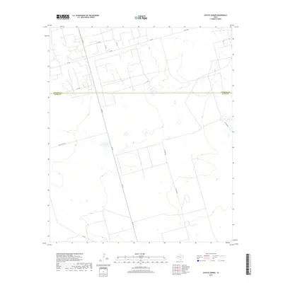
2019 Map of Coyote Corner
USGS Topo · Published 2019About this map
The Andrews Co Ector Co boundary line divides this West Texas landscape, where the flat Permian Basin terrain is defined by a sparse network of ranch roads and intermittent water features. Bum Lake sits as a central landmark in this cattle country, surrounded by a grid of numbered and named routes such as Sheep Pasture Rd and Rch Rd. The prominence of FM 181 (Farm to Market 181) as the primary north-south artery highlights the rural, ranch-centric infrastructure of the region. This 2019 survey captures the area's modern layout of fence lines and access roads, illustrating the continued significance of large land holdings and industrial transit routes like N Station Rd in the high plains of Ector and Andrews counties.
Find a feature on this map
13 named features on this map. Tap any name to fly to it.
Don’t see what you’re looking for? This feature index may not catch every label — zoom into the map to look around manually.
Map Details
Editions of this 2019 Coyote Corner Map
This is the sole edition of this map. No revisions or reprints were ever made.
Other maps of this area

1954 · Hobbs
USGS Topo · 1:250,000

1954 · Pecos
USGS Topo · 1:250,000

1957 · Pecos
USGS Topo · 1:250,000

1958 · Hobbs
USGS Topo · 1:250,000

1964 · Turnbaugh Corner
USGS Topo · 1:24,000

1965 · Goldsmith
USGS Topo · 1:24,000

1967 · North Cowden
USGS Topo · 1:24,000

1968 · Coyote Corner
USGS Topo · 1:24,000

1968 · North Cowden NW
USGS Topo · 1:24,000

1968 · Clabber Hill Ranch
USGS Topo · 1:24,000