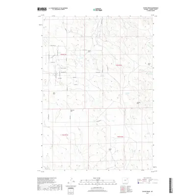
2017 Map of Coyote Draw
USGS Topo · Published 2017About this map
Coyote Draw and the surrounding drainage basins of Campbell County define this 2017 landscape, revealing a territory primarily organized around ranching infrastructure and local resource management. The map details a sophisticated network of water catchments including Coyote Reservoir, Drum Reservoir, and Coal Mine Reservoir, which are vital for supporting livestock in this arid environment. The road names offer a unique cultural window into the local identity and daily life, with thoroughfares such as Bull Riding Rd, Steer Roping Ave, and Coal Train Rd referencing both the regional equestrian heritage and the industrial influence of the nearby coal fields. Geologic and topographic points of interest like Sharp Butte and Gold Mine Draw provide landmarks for those studying the physical geography or historical land use of this Wyoming high plains region.
Find a feature on this map
39 named features on this map. Tap any name to fly to it.
Don’t see what you’re looking for? This feature index may not catch every label — zoom into the map to look around manually.
Map Details
Editions of this 2017 Coyote Draw Map
This is the sole edition of this map. No revisions or reprints were ever made.
Other maps of this area

1954 · Gillette
USGS Topo · 1:250,000

1955 · Gillette
USGS Topo · 1:250,000

1958 · Gillette
USGS Topo · 1:250,000

1962 · Gillette
USGS Topo · 1:250,000

1971 · Coyote Draw
USGS Topo · 1:24,000

1971 · Coon Track Creek
USGS Topo · 1:24,000

1971 · The Gap SW
USGS Topo · 1:24,000

1971 · Whitetail Creek
USGS Topo · 1:24,000

1971 · Rozet
USGS Topo · 1:24,000

1971 · Gillette East
USGS Topo · 1:24,000