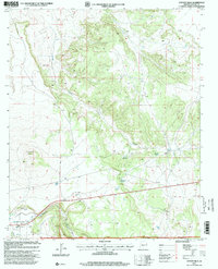
1997 Map of Coyote Hills
USGS Topo · Published 2000About this map
Coyote Hills dominates the topography of this section of the Apache National Forest in Apache County, where the high-country landscape is defined by its water sources and grazing infrastructure. The settlement of Coyote and the nearby Coyote Ranch are situated along the drainage of Coyote Creek, which winds through the central terrain. Further south, the map reveals the northern edge of Round Valley, where Nutrioso Creek cuts across the land. The presence of numerous labeled corrals and vital water points like Horseshoe Spring and Coyote Spring suggests a landscape heavily utilized for livestock and ranching. Small-scale industrial activity is also evident through the Gravel Pit and Cinder Pit, which are characteristic of the region's geological and development history at the end of the 20th century.
Find a feature on this map
13 named features on this map. Tap any name to fly to it.
Don’t see what you’re looking for? This feature index may not catch every label — zoom into the map to look around manually.
Map Details
Editions of this 1997 Coyote Hills Map
This is the sole edition of this map. No revisions or reprints were ever made.
Other maps of this area

1886 · St Johns
USGS Topo · 1:250,000

1892 · St Johns
USGS Topo · 1:250,000

1954 · Saint Johns
USGS Topo · 1:250,000

1957 · Saint Johns
USGS Topo · 1:250,000

1958 · Saint Johns
USGS Topo · 1:250,000

1962 · Saint Johns
USGS Topo · 1:250,000
1968 · Nelson Reservoir NE
USGS Topo · 1:24,000
1968 · Loco Knoll
USGS Topo · 1:24,000

1969 · Coyote Hills
USGS Topo · 1:24,000
1969 · Eagar
USGS Topo · 1:24,000