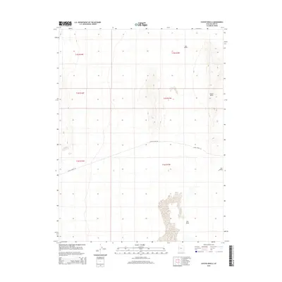
2014 Map of Coyote Knolls
USGS Topo · Published 2014About this map
Tule Valley defines the arid landscape of this 2014 survey in Millard County. The terrain is characterized by the prominent elevation of the Coyote Knolls to the east and smaller island-like formations in the center of the sheet. Modern infrastructure is limited in this desert expanse, anchored primarily by Coyote Springs Rd, which provides the principal east-west transit across the basin. The map documents the vast, open character of the Great Basin, reflecting the minimal human footprint and the reliance on a few established dirt routes to navigate the salt flats and desert brush between the low mountain ranges.
Find a feature on this map
7 named features on this map. Tap any name to fly to it.
Don’t see what you’re looking for? This feature index may not catch every label — zoom into the map to look around manually.
Map Details
Editions of this 2014 Coyote Knolls Map
This is the sole edition of this map. No revisions or reprints were ever made.
Other maps of this area

1908 · Fish Springs
USGS Topo · 1:250,000

1910 · Fish Springs
USGS Topo · 1:250,000

1953 · Delta
USGS Topo · 1:250,000

1958 · Delta
USGS Topo · 1:250,000

1959 · Cowboy Pass
USGS Topo · 1:62,500

1960 · Granite Mountain
USGS Topo · 1:62,500

1962 · Delta
USGS Topo · 1:250,000

1967 · Sand Pass
USGS Topo · 1:24,000

1972 · Swasey Peak SW
USGS Topo · 1:24,000
1972 · Swasey Peak NW
USGS Topo · 1:24,000