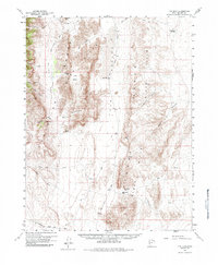
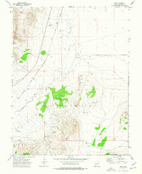
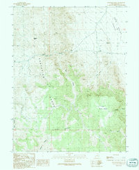
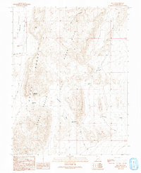
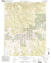
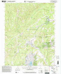
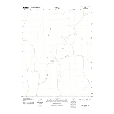
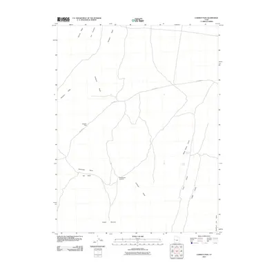
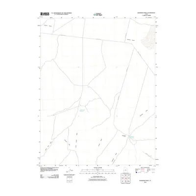
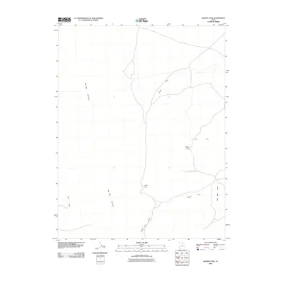
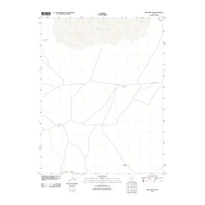
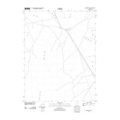
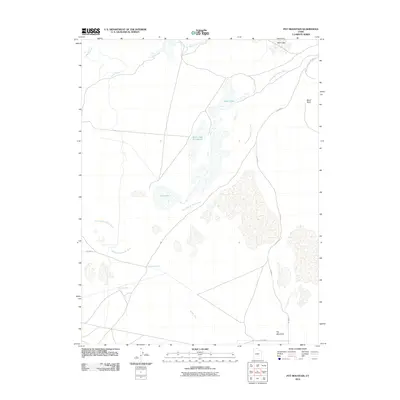
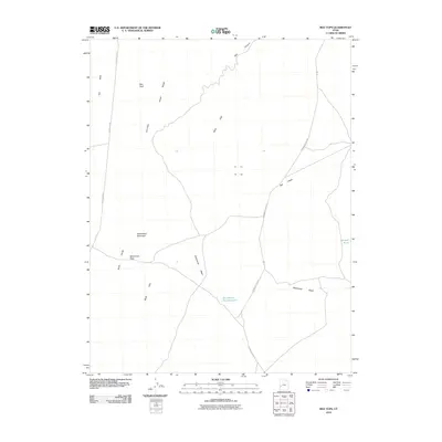
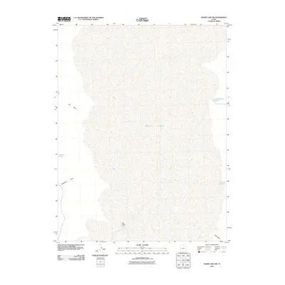
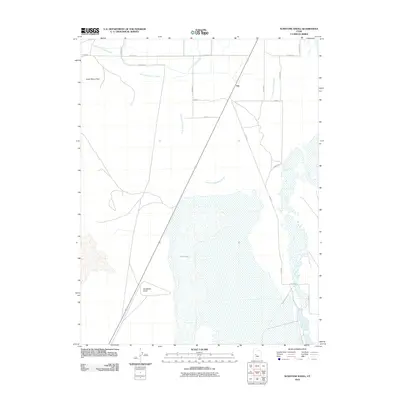
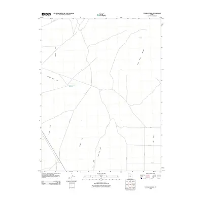
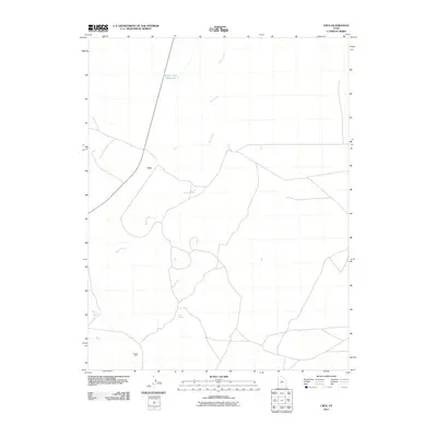
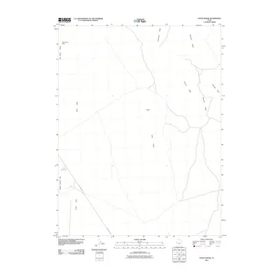
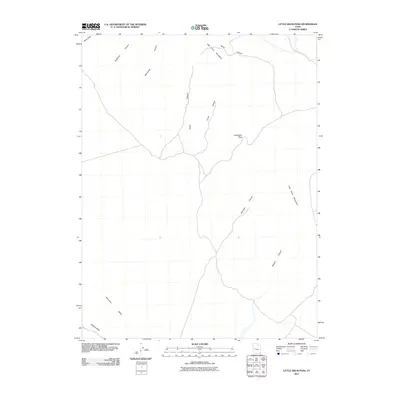
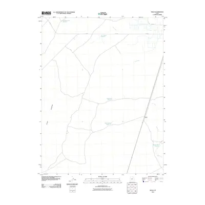
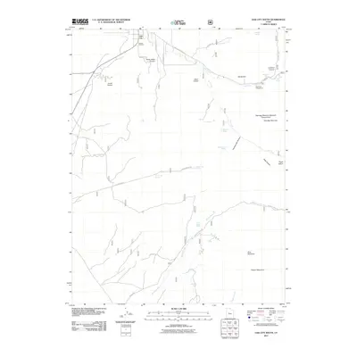
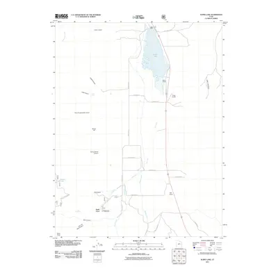
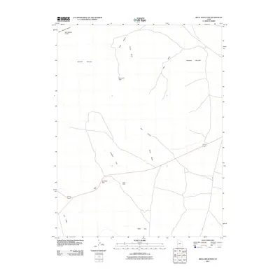
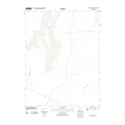
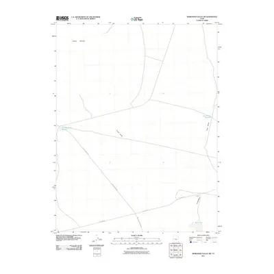
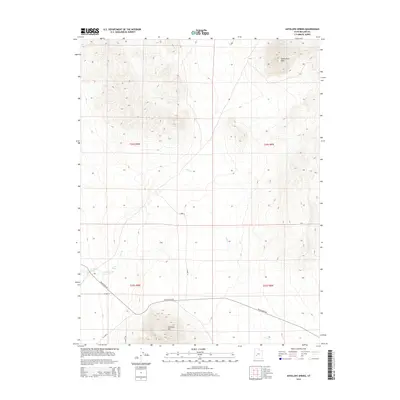
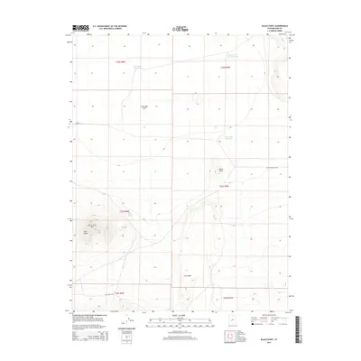
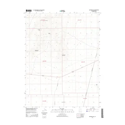
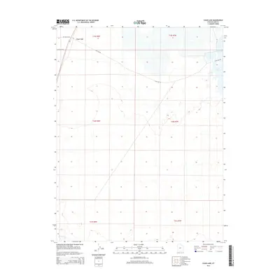
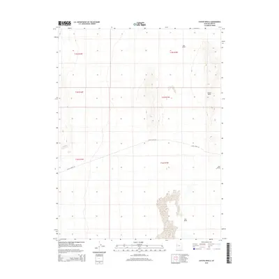
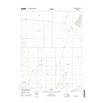
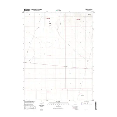
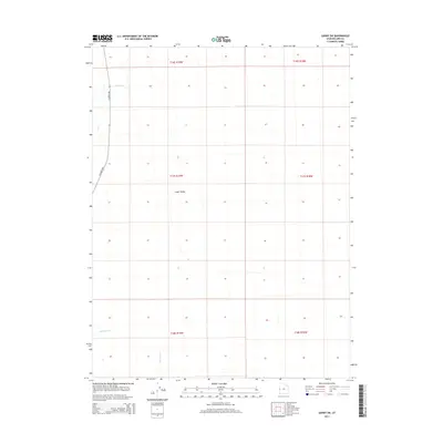
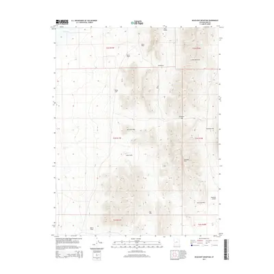
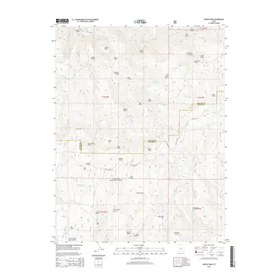
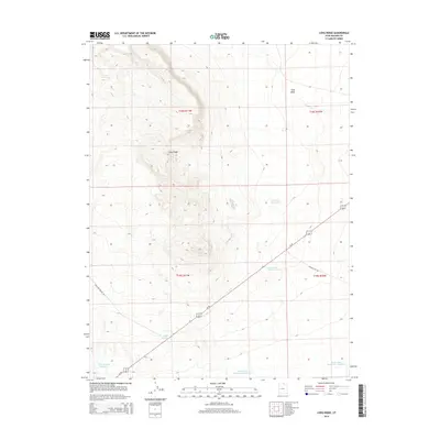
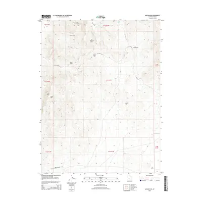
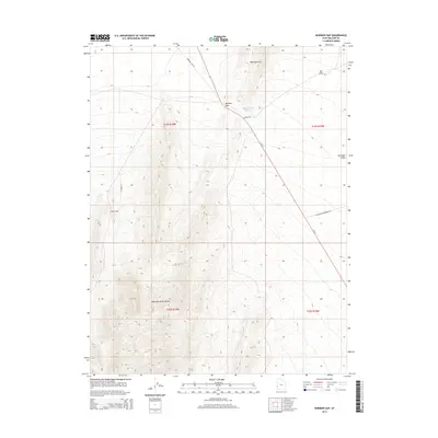
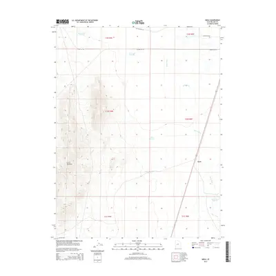
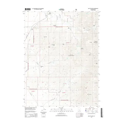
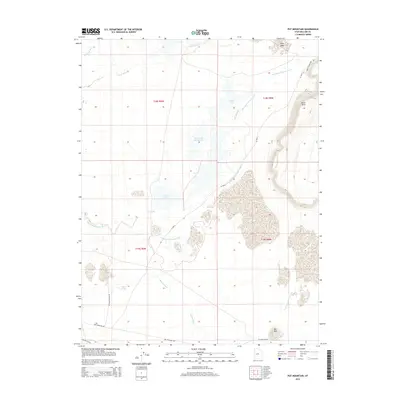
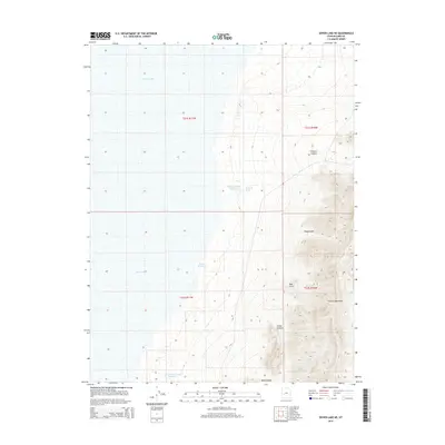
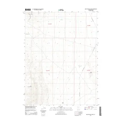
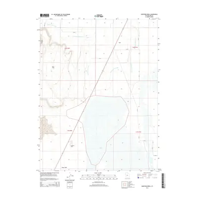
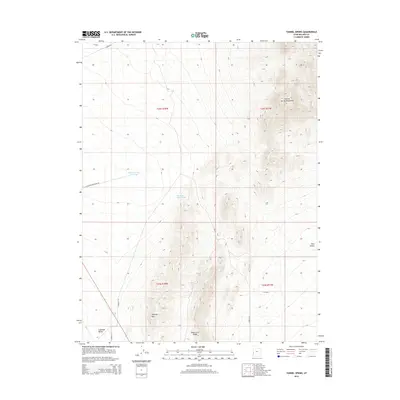
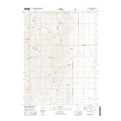
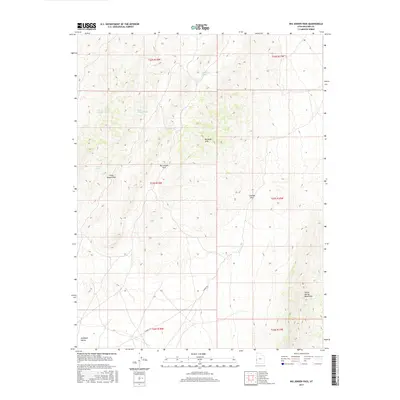
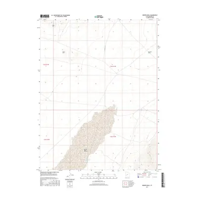
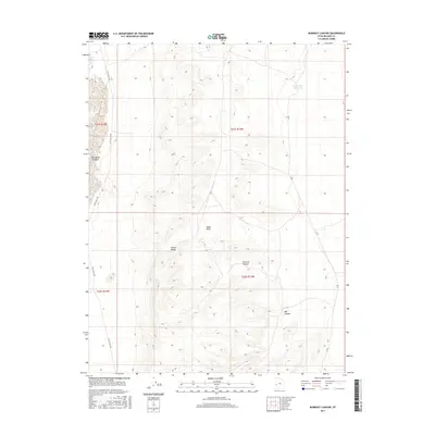
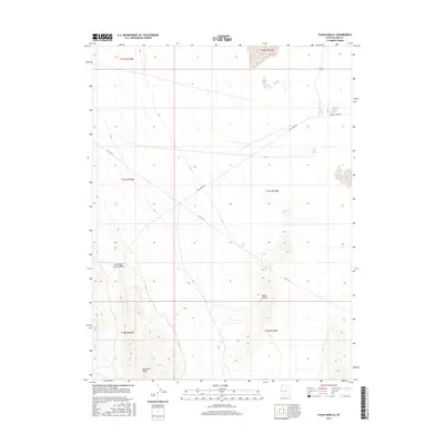
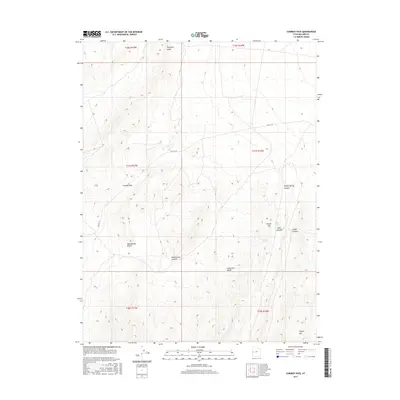
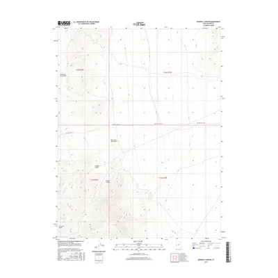
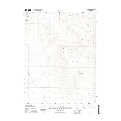
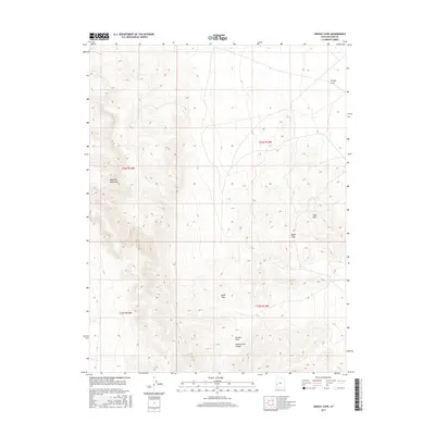
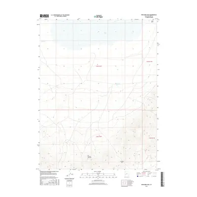
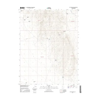
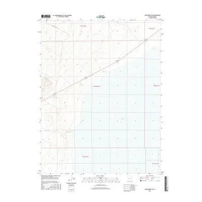
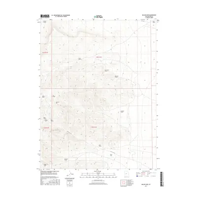
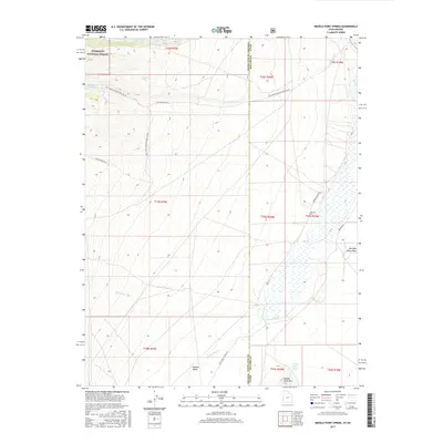
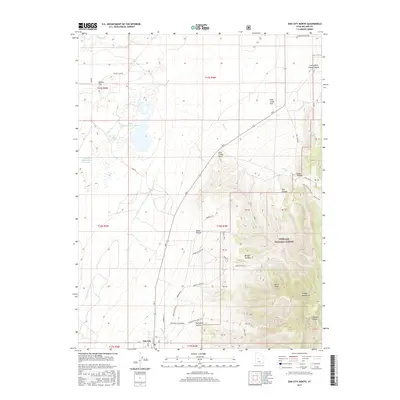
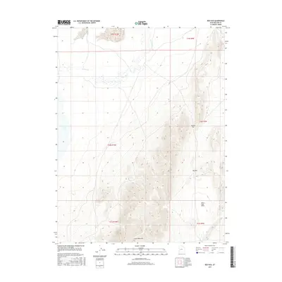
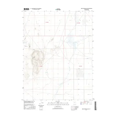
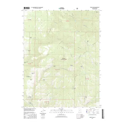
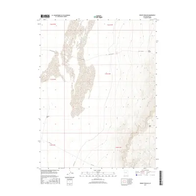
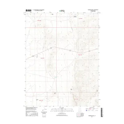
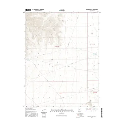
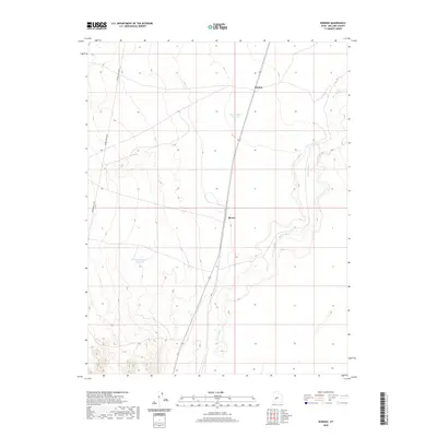
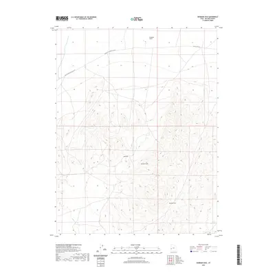
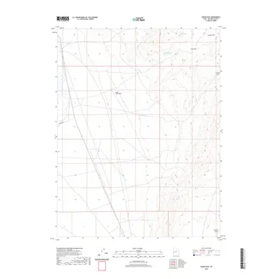
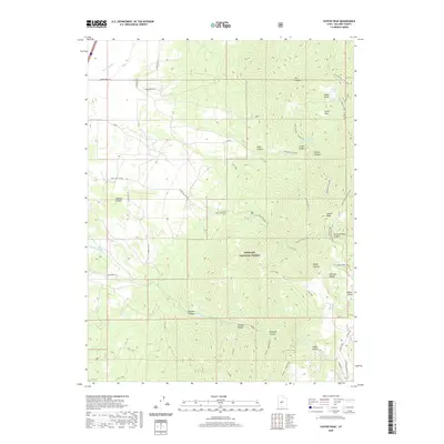
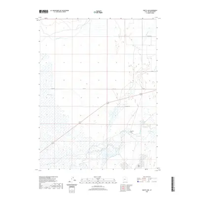
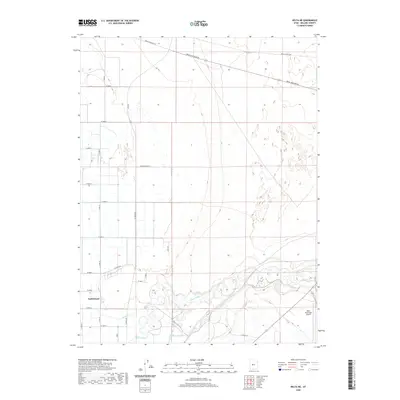
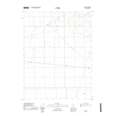
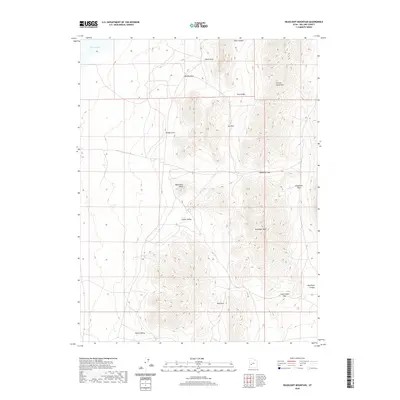
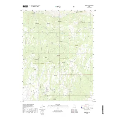
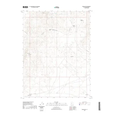
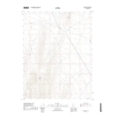
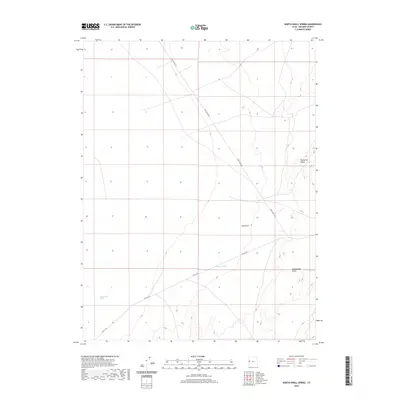
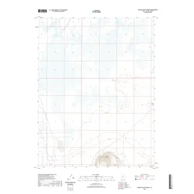
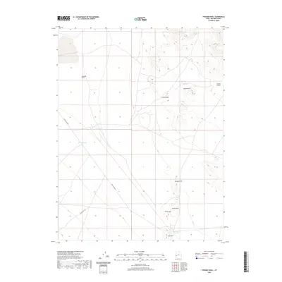
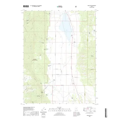
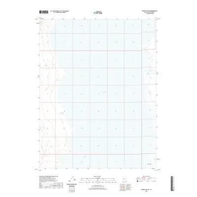
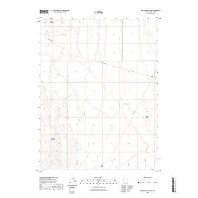
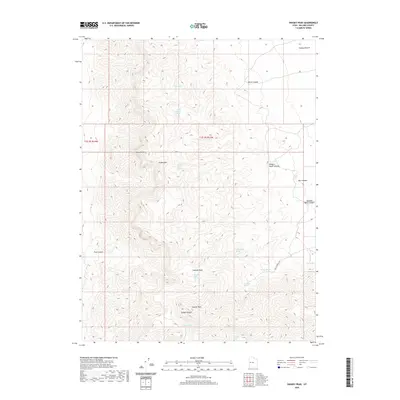
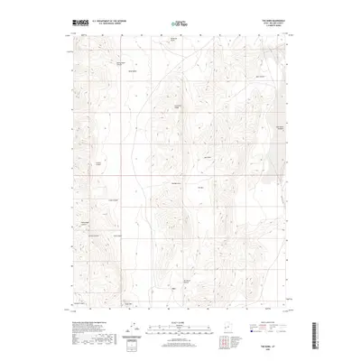
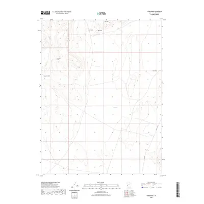
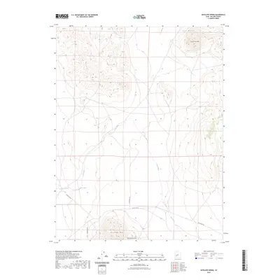
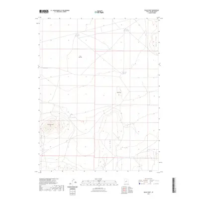
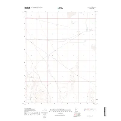
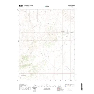
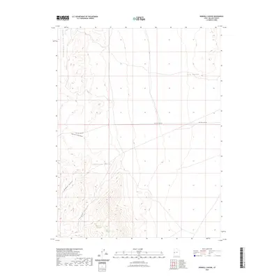
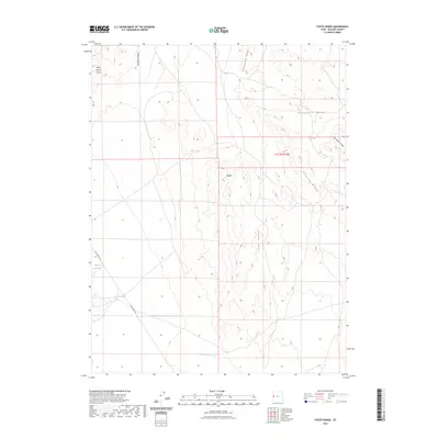
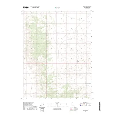
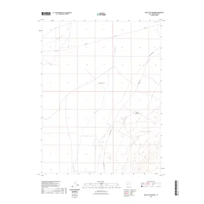
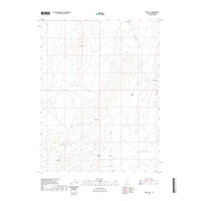
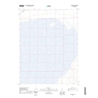
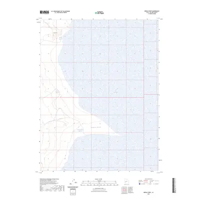
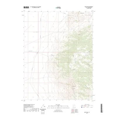
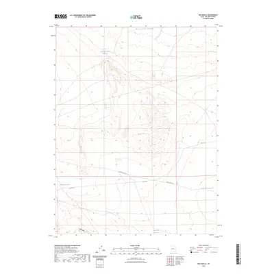
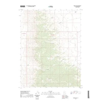
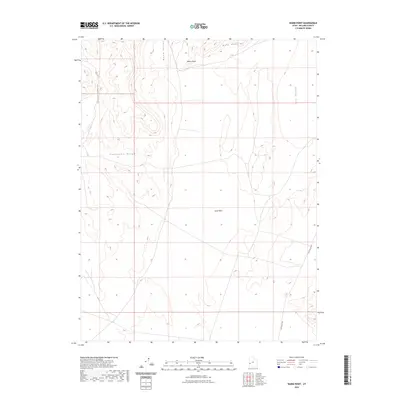
1972 Map of Swasey Peak SW
USGS Topo · Published 1974About this map
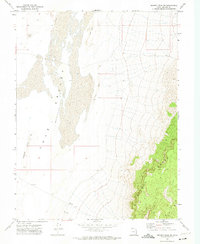
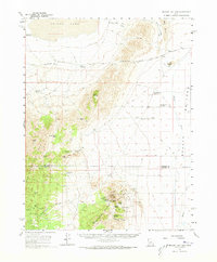
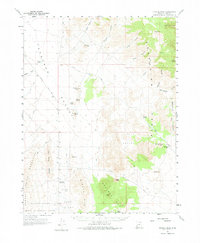
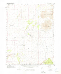
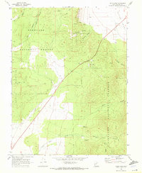
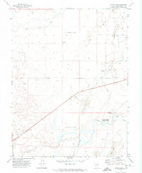
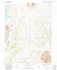
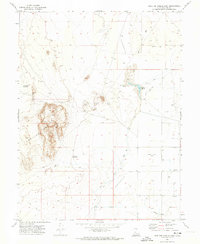
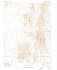
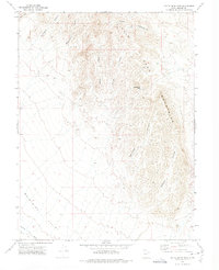
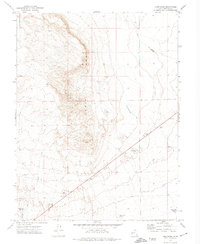
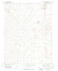
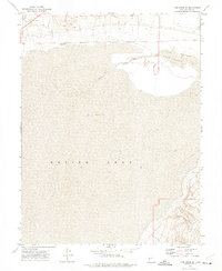
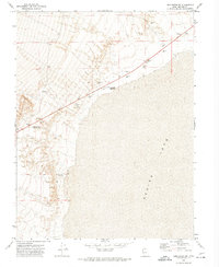
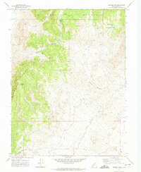
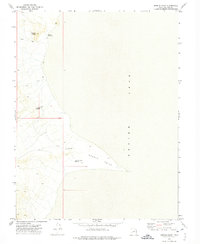
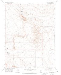
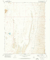
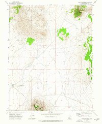
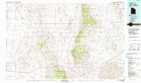
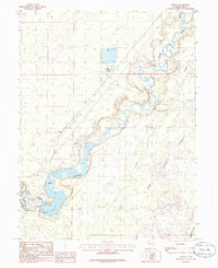
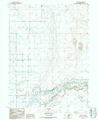
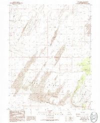
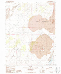
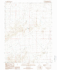
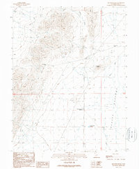
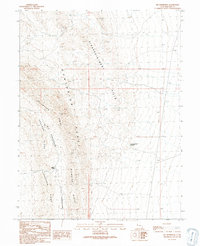
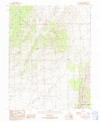
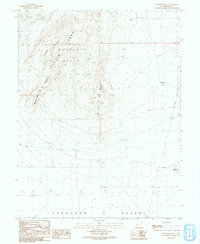
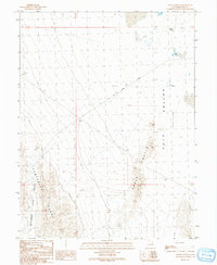
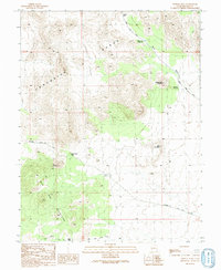
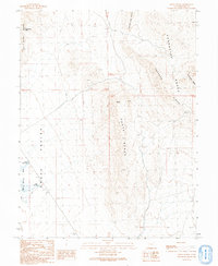
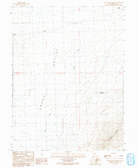
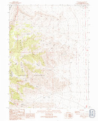
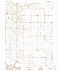
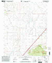
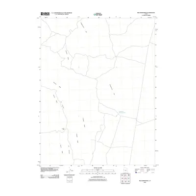
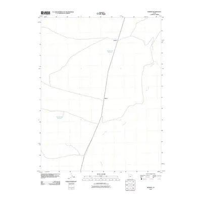
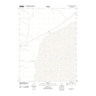
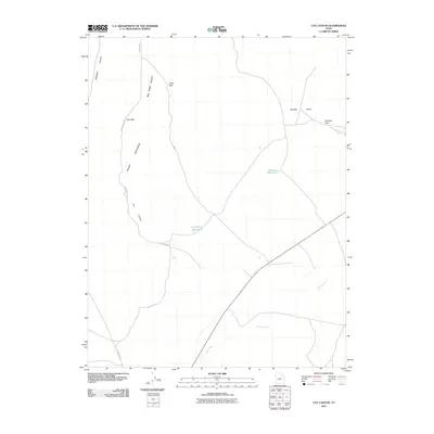
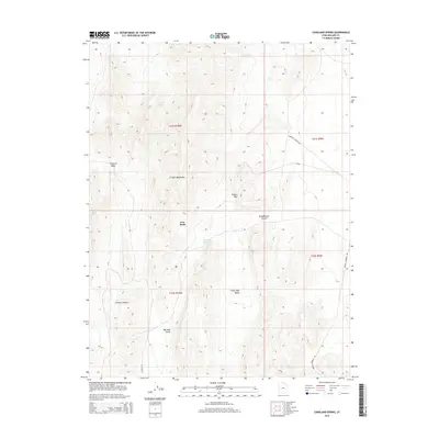
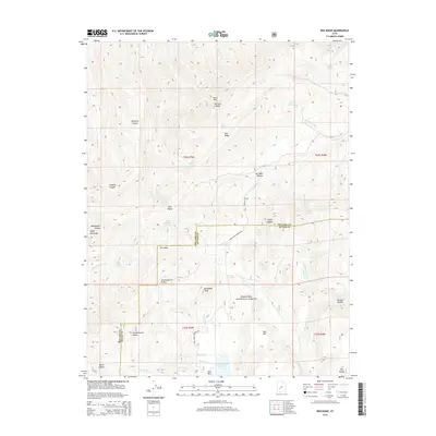
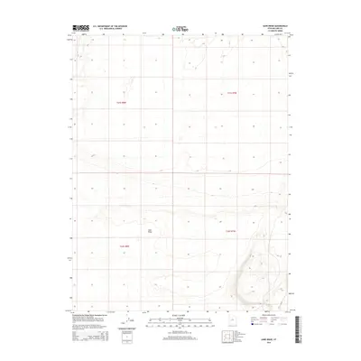
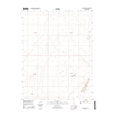
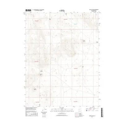
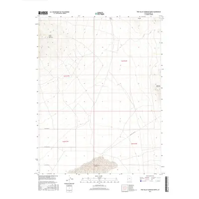
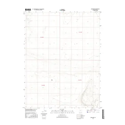
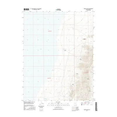
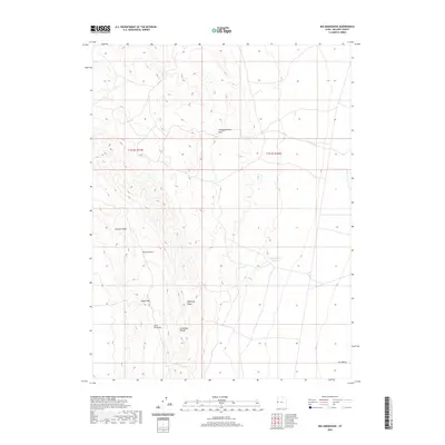
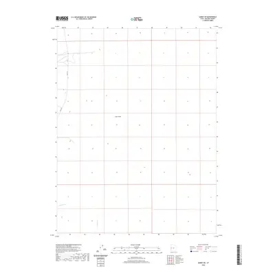
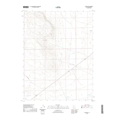
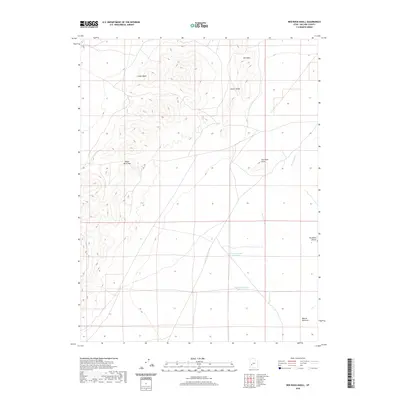
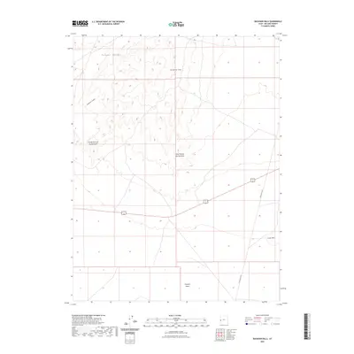
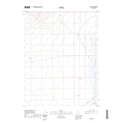
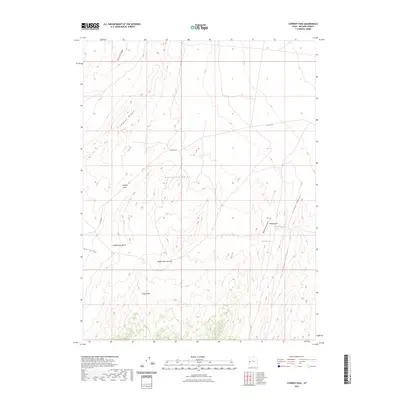
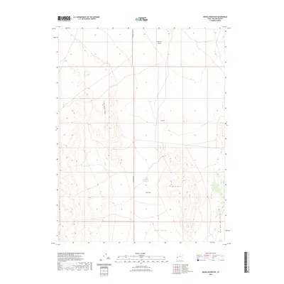
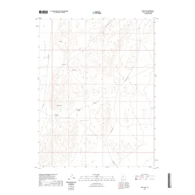
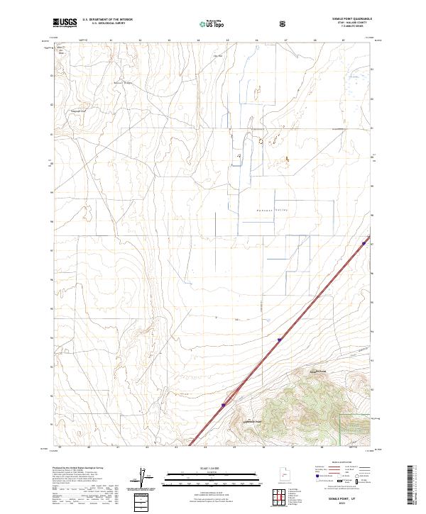
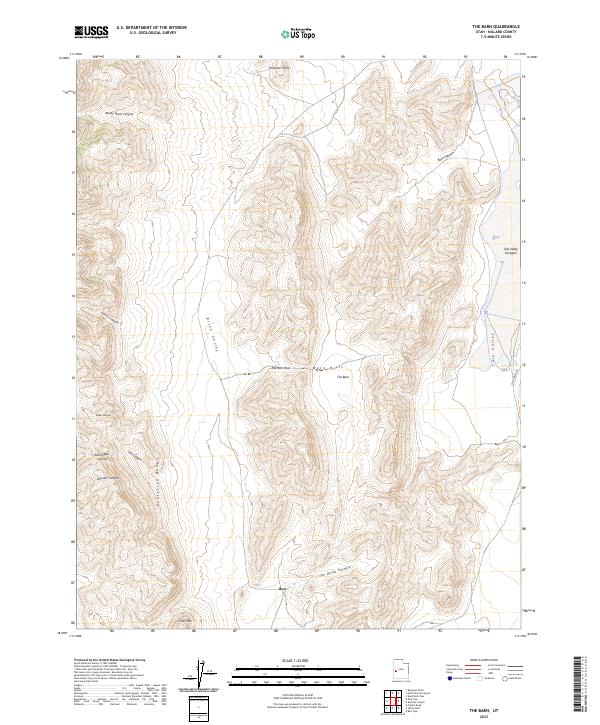
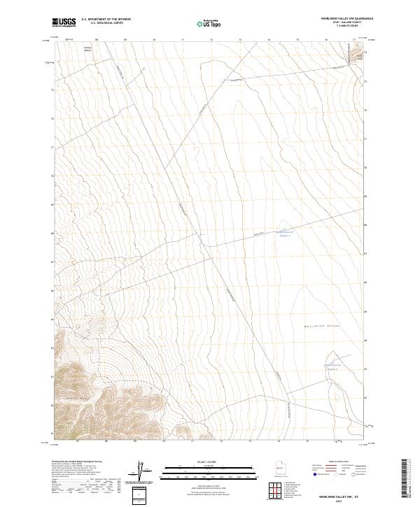
The Tule Valley (Depression) dominates this section of Millard County, characterized by a stark desert landscape of Sand Dunes and the prominent rising slopes of the House Range. In the early 1970s, this area remained largely undeveloped, with the small settlement of Parto and a solitary Well serving as the primary evidence of human presence in the valley floor. To the west, the Smelter Hills flank the valley, while the eastern edge is defined by the steep contours of the range reaching toward the Middle section. The map reveals a remote geography where transportation is limited to unimproved roads, and surveying benchmarks like BM 4541 and BM 4491 provide the only precise coordinates for navigating this arid basin.
Find a feature on this map
14 named features on this map. Tap any name to fly to it.
Don’t see what you’re looking for? This feature index may not catch every label — zoom into the map to look around manually.
Map Details
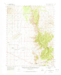
Editions of this 1972 Swasey Peak SW Map
2 editions found
Historical Maps of Millard County Through Time
632 maps found
1885 Sevier Desert
Millard County, UT

1908 Fish Springs
Millard County, UT
1910 Fish Springs
Millard County, UT
1959 Cowboy Pass
Millard County, UT
1960 Beaver Lake Mts.
Millard County, UT
1960 Burbank Hills
Millard County, UT
1960 Conger Mountain
Millard County, UT
1960 Conger Range
Millard County, UT
1960 Crystal Peak
Millard County, UT
1960 Frisco Peak
Millard County, UT
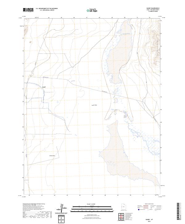
1960 Gandy
Millard County, UT
1960 Notch Peak
Millard County, UT
1960 The Barn
Millard County, UT
1960 Wah Wah Summit
Millard County, UT
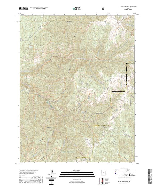
1961 Mt. Catherine
Millard County, UT
1962 Cove Fort
Millard County, UT
1962 Tabernacle Hill
Millard County, UT
1962 The Sink
Millard County, UT
1969 Coffee Peak
Millard County, UT
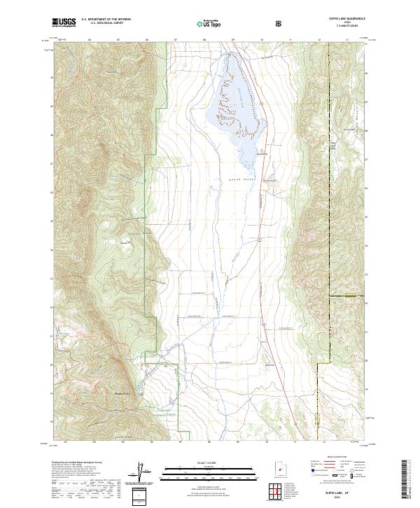
1969 Scipio Lake
Millard County, UT
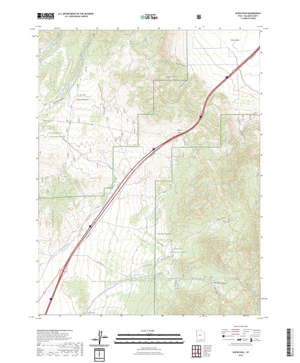
1969 Scipio Pass
Millard County, UT
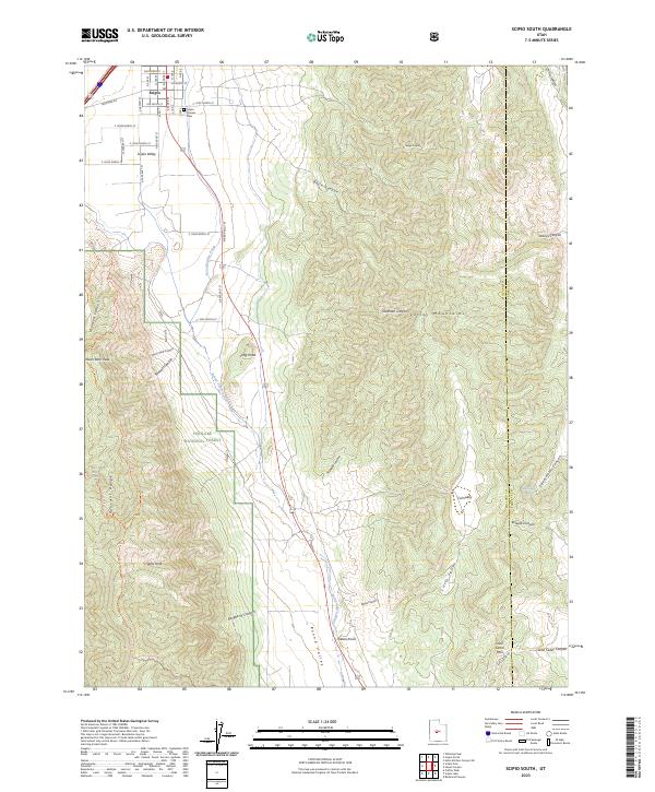
1969 Scipio South
Millard County, UT
1971 Clay Knoll
Millard County, UT
1971 Clear Lake
Millard County, UT
1971 Crafts Lake
Millard County, UT
1971 Mormon Gap
Millard County, UT
1971 Neels
Millard County, UT
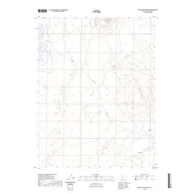
1971 Pahvant Butte North
Millard County, UT
1971 Pahvant Butte South
Millard County, UT
1971 Pot Mountain
Millard County, UT
1971 Red Pass
Millard County, UT
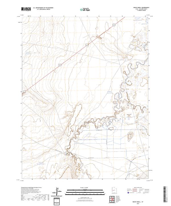
1971 Rocky Knoll
Millard County, UT
1971 Smelter Knolls East
Millard County, UT
1971 Smelter Knolls West
Millard County, UT
1971 Sunstone Knoll
Millard County, UT
1971 Tunnel Spring
Millard County, UT
1972 Headlight Mtn
Millard County, UT
1972 Little Drum Pass
Millard County, UT
1972 Long Ridge
Millard County, UT
1972 Long Ridge Reservoir
Millard County, UT
1972 Long Ridge SE
Millard County, UT
1972 Long Ridge SW
Millard County, UT
1972 Marjum Pass
Millard County, UT
1972 Needle Point
Millard County, UT
1972 Red Knolls
Millard County, UT
1972 Sevier Lake NE
Millard County, UT
1972 Sevier Lake SW
Millard County, UT
1972 Swasey Peak
Millard County, UT
1972 Swasey Peak NW
Millard County, UT
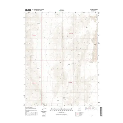
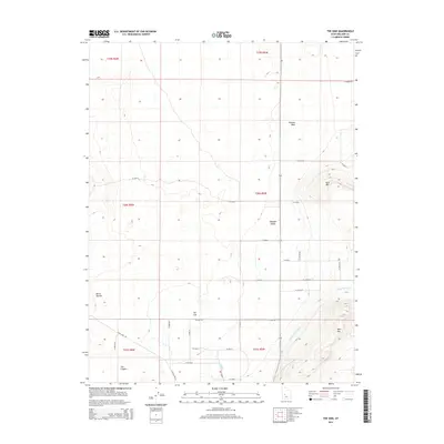
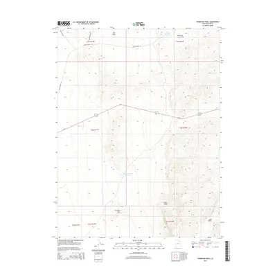
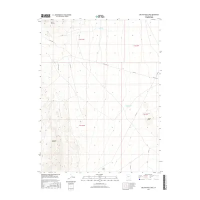
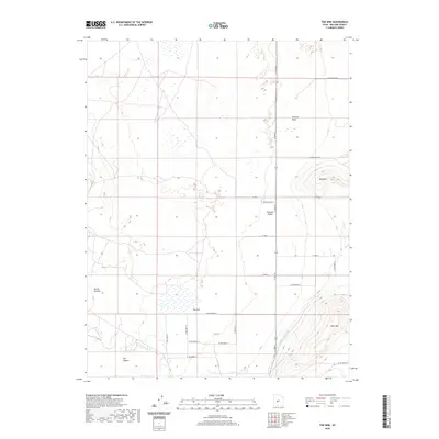
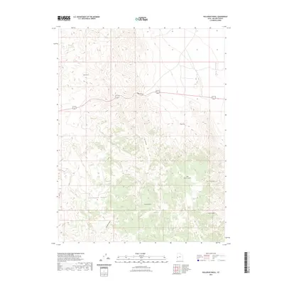
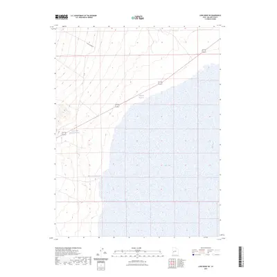
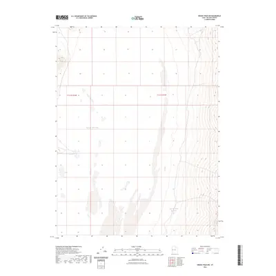
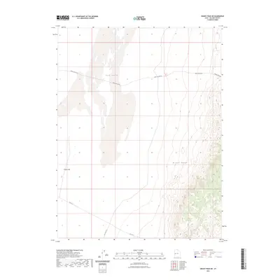
1972 Swasey Peak SW
Millard County, UT
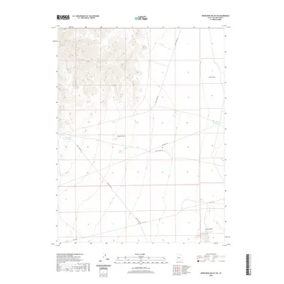
1972 Whirlwind Valley NW
Millard County, UT
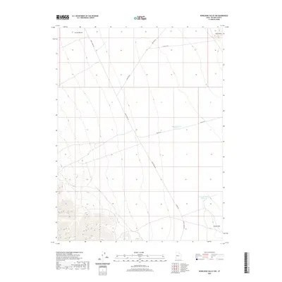
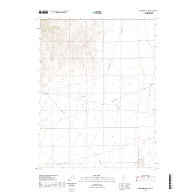
1972 Whirlwind Valley SW
Millard County, UT
1973 Antelope Spring
Millard County, UT
1973 Black Rock
Millard County, UT

1973 Borden
Millard County, UT
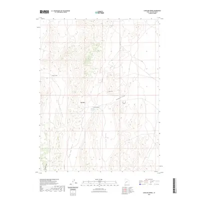
1973 Candland Spring
Millard County, UT
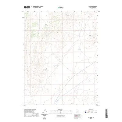
1973 Cat Canyon
Millard County, UT
1973 Cruz
Millard County, UT
1980 Joseph Peak
Millard County, UT
1980 Wah Wah Mts. North
Millard County, UT
1981 Red Ridge
Millard County, UT
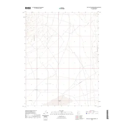
1981 Tule Valley
Millard County, UT
1985 Harding
Millard County, UT
1985 Oak City North
Millard County, UT
1985 Oak City South
Millard County, UT
1985 Strong
Millard County, UT
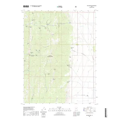
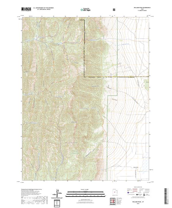
1985 Williams Peak
Millard County, UT
1986 Antelope Valley
Millard County, UT
1986 Black Point
Millard County, UT
1986 Delta NE
Millard County, UT
1986 Dog Valley Peak
Millard County, UT
1986 Duggins Creek
Millard County, UT
1986 Mc Cornick
Millard County, UT
1986 Sand Ridge
Millard County, UT
1986 Sixmile Point
Millard County, UT
1986 Spring Mountain
Millard County, UT
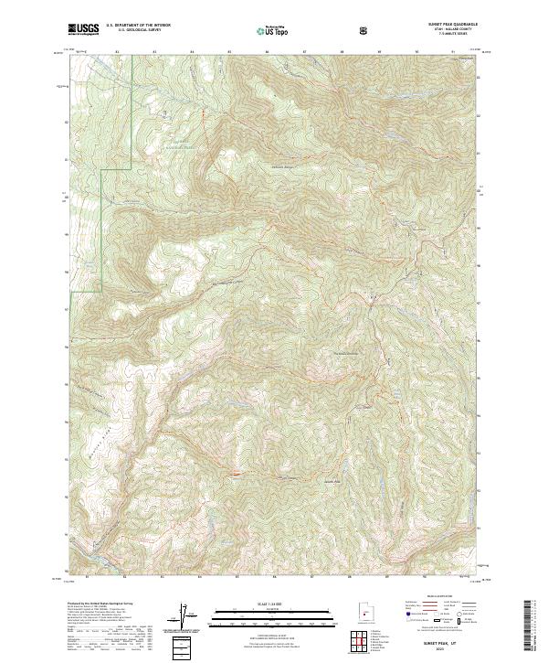
1986 Sunset Peak
Millard County, UT
1986 Tabernacle Hill
Millard County, UT
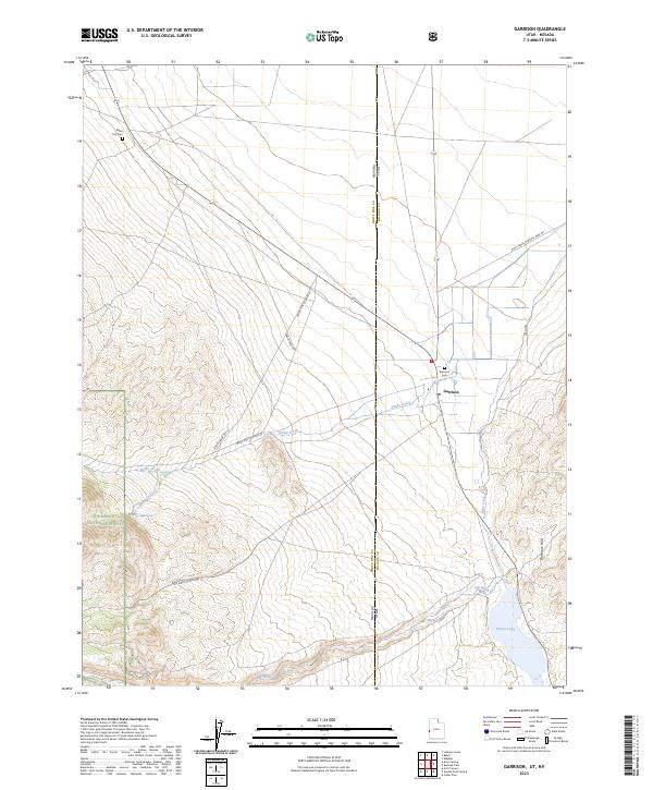
1987 Garrison
Millard County, UT
1987 Needle Point Spring
Millard County, UT
1989 Brown Knoll
Millard County, UT
1989 Fifteenmile Point
Millard County, UT
1989 Grassy Cove
Millard County, UT
1989 Iron Mine Pass
Millard County, UT
1989 Pine Valley Hardpan North
Millard County, UT
1989 Red Rock Knoll
Millard County, UT
1991 Big Horseshoe
Millard County, UT
1991 Big Jensen Pass
Millard County, UT
1991 Buckskin Hills
Millard County, UT
1991 Bullgrass Knoll
Millard County, UT
1991 Burbank Pass
Millard County, UT
1991 Burnout Canyon
Millard County, UT
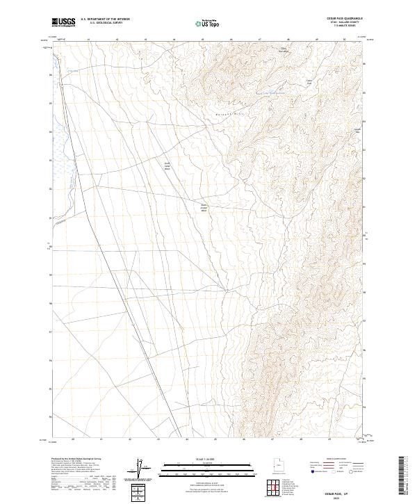
1991 Cedar Pass
Millard County, UT
1991 Chalk Knolls
Millard County, UT
1991 Conger Mountain
Millard County, UT
1991 Cowboy Pass
Millard County, UT
1991 Coyote Knolls
Millard County, UT
1991 Crystal Peak
Millard County, UT
1991 Deadman Point
Millard County, UT
1991 Dowdell Canyon
Millard County, UT
1991 Eskdale
Millard County, UT
1991 Foote Range
Millard County, UT
1991 Gandy
Millard County, UT
1991 Gandy SW
Millard County, UT
1991 Hell'n Moriah Canyon
Millard County, UT
1991 Hole In The Ground
Millard County, UT
1991 King Top
Millard County, UT
1991 Knoll Hill
Millard County, UT
1991 Middle Mountain
Millard County, UT
1991 Miller Cove
Millard County, UT
1991 North Knoll Spring
Millard County, UT
1991 Notch Peak
Millard County, UT
1991 Pyramid Knoll
Millard County, UT
1991 Red Tops
Millard County, UT
1991 Skull Rock Pass
Millard County, UT
1991 The Barn
Millard County, UT
1991 Thompson Knoll
Millard County, UT
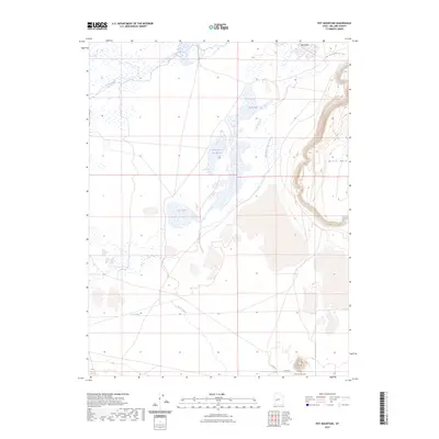
1991 Warm Point
Millard County, UT
2001 Coffee Peak
Millard County, UT
2001 Dog Valley Peak
Millard County, UT
2001 Duggins Creek
Millard County, UT
2001 Joseph Peak
Millard County, UT
2001 Mount Catherine
Millard County, UT
2001 Oak City North
Millard County, UT
2001 Oak City South
Millard County, UT
2001 Red Ridge
Millard County, UT
2001 Scipio Lake
Millard County, UT
2001 Scipio Pass
Millard County, UT
2001 Scipio South
Millard County, UT
2001 Sixmile Point
Millard County, UT
2001 Sunset Peak
Millard County, UT
2001 Williams Peak
Millard County, UT
2010 Antelope Valley
Millard County, UT
2010 Big Horseshoe
Millard County, UT
2010 Big Jensen Pass
Millard County, UT
2010 Black Point
Millard County, UT
2010 Black Rock
Millard County, UT
2010 Borden
Millard County, UT
2010 Brown Knoll
Millard County, UT
2010 Buckskin Hills
Millard County, UT
2010 Burbank Pass
Millard County, UT

2010 Burnout Canyon
Millard County, UT
2010 Candland Spring
Millard County, UT
2010 Clay Knoll
Millard County, UT
2010 Clear Lake
Millard County, UT
2010 Conger Mountain
Millard County, UT
2010 Cowboy Pass
Millard County, UT
2010 Coyote Knolls
Millard County, UT
2010 Crafts Lake
Millard County, UT
2010 Crystal Peak
Millard County, UT
2010 Deadman Point
Millard County, UT

2010 Delta NE
Millard County, UT
2010 Dowdell Canyon
Millard County, UT
2010 Fifteenmile Point
Millard County, UT

2010 Gandy
Millard County, UT
2010 Gandy SW
Millard County, UT
2010 Grassy Cove
Millard County, UT
2010 Harding
Millard County, UT
2010 Headlight Mountain
Millard County, UT
2010 Hell'n Moriah Canyon
Millard County, UT
2010 Iron Mine Pass
Millard County, UT
2010 King Top
Millard County, UT
2010 Long Ridge Reservoir
Millard County, UT
2010 Long Ridge SE
Millard County, UT
2010 Long Ridge SW
Millard County, UT
2010 McCornick
Millard County, UT
2010 Middle Mountain
Millard County, UT
2010 Miller Cove
Millard County, UT
2010 Mormon Gap
Millard County, UT
2010 Needle Point
Millard County, UT
2010 Pahvant Butte North
Millard County, UT
2010 Pine Valley Hardpan North
Millard County, UT
2010 Pot Mountain
Millard County, UT
2010 Pyramid Knoll
Millard County, UT
2010 Red Pass
Millard County, UT
2010 Red Rock Knoll
Millard County, UT
2010 Red Tops
Millard County, UT
2010 Rocky Knoll
Millard County, UT
2010 Sand Ridge
Millard County, UT
2010 Sevier Lake NE
Millard County, UT
2010 Sevier Lake SW
Millard County, UT
2010 Smelter Knolls East
Millard County, UT
2010 Smelter Knolls West
Millard County, UT
2010 Strong
Millard County, UT
2010 Sunstone Knoll
Millard County, UT
2010 Swasey Peak
Millard County, UT
2010 The Barn
Millard County, UT
2010 The Sink
Millard County, UT
2010 Tunnel Spring
Millard County, UT
2010 Warm Point
Millard County, UT
2011 Antelope Spring
Millard County, UT
2011 Bullgrass Knoll
Millard County, UT
2011 Cat Canyon
Millard County, UT
2011 Cedar Pass
Millard County, UT
2011 Chalk Knolls
Millard County, UT
2011 Coffee Peak
Millard County, UT
2011 Cruz
Millard County, UT
2011 Dog Valley Peak
Millard County, UT
2011 Duggins Creek
Millard County, UT
2011 Eskdale
Millard County, UT
2011 Foote Range
Millard County, UT
2011 Hole in the Ground
Millard County, UT
2011 Joseph Peak
Millard County, UT
2011 Knoll Hill
Millard County, UT
2011 Little Drum Pass
Millard County, UT
2011 Long Ridge
Millard County, UT
2011 Marjum Pass
Millard County, UT
2011 Mount Catherine
Millard County, UT
2011 Neels
Millard County, UT
2011 North Knoll Spring
Millard County, UT
2011 Notch Peak
Millard County, UT
2011 Oak City North
Millard County, UT
2011 Oak City South
Millard County, UT
2011 Pahvant Butte South
Millard County, UT
2011 Red Knolls
Millard County, UT
2011 Red Ridge
Millard County, UT
2011 Scipio Lake
Millard County, UT
2011 Scipio Pass
Millard County, UT
2011 Scipio South
Millard County, UT
2011 Sixmile Point
Millard County, UT
2011 Skull Rock Pass
Millard County, UT
2011 Spring Mountain
Millard County, UT
2011 Sunset Peak
Millard County, UT
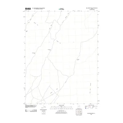
2011 Swasey Peak NW
Millard County, UT
2011 Swasey Peak SW
Millard County, UT
2011 Tabernacle Hill
Millard County, UT
2011 Thompson Knoll
Millard County, UT
2011 Whirlwind Valley NW
Millard County, UT
2011 Whirlwind Valley SW
Millard County, UT
2011 Williams Peak
Millard County, UT
2012 Garrison
Millard County, UT
2012 Needle Point Spring
Millard County, UT
2014 Antelope Spring
Millard County, UT
2014 Antelope Valley
Millard County, UT
2014 Big Horseshoe
Millard County, UT
2014 Big Jensen Pass
Millard County, UT
2014 Black Point
Millard County, UT
2014 Black Rock
Millard County, UT
2014 Borden
Millard County, UT
2014 Brown Knoll
Millard County, UT
2014 Buckskin Hills
Millard County, UT
2014 Bullgrass Knoll
Millard County, UT
2014 Burbank Pass
Millard County, UT
2014 Burnout Canyon
Millard County, UT
2014 Candland Spring
Millard County, UT
2014 Cat Canyon
Millard County, UT

2014 Cedar Pass
Millard County, UT
2014 Chalk Knolls
Millard County, UT
2014 Clay Knoll
Millard County, UT
2014 Clear Lake
Millard County, UT
2014 Coffee Peak
Millard County, UT
2014 Conger Mountain
Millard County, UT
2014 Cowboy Pass
Millard County, UT
2014 Coyote Knolls
Millard County, UT
2014 Crafts Lake
Millard County, UT
2014 Cruz
Millard County, UT
2014 Crystal Peak
Millard County, UT
2014 Deadman Point
Millard County, UT
2014 Delta NE
Millard County, UT
2014 Dog Valley Peak
Millard County, UT

2014 Dowdell Canyon
Millard County, UT
2014 Duggins Creek
Millard County, UT
2014 Eskdale
Millard County, UT
2014 Fifteenmile Point
Millard County, UT
2014 Foote Range
Millard County, UT
2014 Gandy
Millard County, UT
2014 Gandy SW
Millard County, UT
2014 Garrison
Millard County, UT
2014 Grassy Cove
Millard County, UT
2014 Harding
Millard County, UT
2014 Headlight Mountain
Millard County, UT
2014 Hell'n Moriah Canyon
Millard County, UT
2014 Hole in the Ground
Millard County, UT
2014 Iron Mine Pass
Millard County, UT
2014 Joseph Peak
Millard County, UT
2014 King Top
Millard County, UT
2014 Knoll Hill
Millard County, UT
2014 Little Drum Pass
Millard County, UT
2014 Long Ridge
Millard County, UT
2014 Long Ridge Reservoir
Millard County, UT
2014 Long Ridge SE
Millard County, UT
2014 Long Ridge SW
Millard County, UT
2014 Marjum Pass
Millard County, UT
2014 McCornick
Millard County, UT
2014 Middle Mountain
Millard County, UT
2014 Miller Cove
Millard County, UT
2014 Mormon Gap
Millard County, UT
2014 Mount Catherine
Millard County, UT
2014 Needle Point
Millard County, UT
2014 Needle Point Spring
Millard County, UT
2014 Neels
Millard County, UT
2014 North Knoll Spring
Millard County, UT
2014 Notch Peak
Millard County, UT
2014 Oak City North
Millard County, UT
2014 Oak City South
Millard County, UT
2014 Pahvant Butte North
Millard County, UT
2014 Pahvant Butte South
Millard County, UT
2014 Pine Valley Hardpan North
Millard County, UT
2014 Pot Mountain
Millard County, UT
2014 Pyramid Knoll
Millard County, UT
2014 Red Knolls
Millard County, UT
2014 Red Pass
Millard County, UT
2014 Red Ridge
Millard County, UT
2014 Red Rock Knoll
Millard County, UT
2014 Red Tops
Millard County, UT
2014 Rocky Knoll
Millard County, UT
2014 Sand Ridge
Millard County, UT
2014 Scipio Lake
Millard County, UT
2014 Scipio Pass
Millard County, UT
2014 Scipio South
Millard County, UT
2014 Sevier Lake NE
Millard County, UT
2014 Sevier Lake SW
Millard County, UT

2014 Sixmile Point
Millard County, UT
2014 Skull Rock Pass
Millard County, UT
2014 Smelter Knolls East
Millard County, UT
2014 Smelter Knolls West
Millard County, UT
2014 Spring Mountain
Millard County, UT
2014 Strong
Millard County, UT
2014 Sunset Peak
Millard County, UT
2014 Sunstone Knoll
Millard County, UT
2014 Swasey Peak
Millard County, UT
2014 Swasey Peak NW
Millard County, UT
2014 Swasey Peak SW
Millard County, UT
2014 Tabernacle Hill
Millard County, UT
2014 The Barn
Millard County, UT
2014 The Sink
Millard County, UT
2014 Thompson Knoll
Millard County, UT
2014 Tunnel Spring
Millard County, UT
2014 Warm Point
Millard County, UT
2014 Whirlwind Valley NW
Millard County, UT
2014 Whirlwind Valley SW
Millard County, UT
2014 Williams Peak
Millard County, UT
2017 Antelope Spring
Millard County, UT
2017 Antelope Valley
Millard County, UT
2017 Big Horseshoe
Millard County, UT
2017 Big Jensen Pass
Millard County, UT
2017 Black Point
Millard County, UT
2017 Black Rock
Millard County, UT
2017 Borden
Millard County, UT
2017 Brown Knoll
Millard County, UT
2017 Buckskin Hills
Millard County, UT
2017 Bullgrass Knoll
Millard County, UT
2017 Burbank Pass
Millard County, UT
2017 Burnout Canyon
Millard County, UT
2017 Candland Spring
Millard County, UT
2017 Cat Canyon
Millard County, UT
2017 Cedar Pass
Millard County, UT
2017 Chalk Knolls
Millard County, UT
2017 Clay Knoll
Millard County, UT
2017 Clear Lake
Millard County, UT
2017 Coffee Peak
Millard County, UT

2017 Conger Mountain
Millard County, UT
2017 Cowboy Pass
Millard County, UT
2017 Coyote Knolls
Millard County, UT
2017 Crafts Lake
Millard County, UT
2017 Cruz
Millard County, UT
2017 Crystal Peak
Millard County, UT
2017 Deadman Point
Millard County, UT
2017 Delta NE
Millard County, UT
2017 Dog Valley Peak
Millard County, UT
2017 Dowdell Canyon
Millard County, UT
2017 Duggins Creek
Millard County, UT
2017 Eskdale
Millard County, UT
2017 Fifteenmile Point
Millard County, UT
2017 Foote Range
Millard County, UT
2017 Gandy
Millard County, UT
2017 Gandy SW
Millard County, UT
2017 Garrison
Millard County, UT
2017 Grassy Cove
Millard County, UT
2017 Harding
Millard County, UT
2017 Headlight Mountain
Millard County, UT

2017 Hell'n Moriah Canyon
Millard County, UT
2017 Hole in the Ground
Millard County, UT
2017 Iron Mine Pass
Millard County, UT
2017 Joseph Peak
Millard County, UT
2017 King Top
Millard County, UT
2017 Knoll Hill
Millard County, UT
2017 Little Drum Pass
Millard County, UT
2017 Long Ridge
Millard County, UT
2017 Long Ridge Reservoir
Millard County, UT
2017 Long Ridge SE
Millard County, UT
2017 Long Ridge SW
Millard County, UT
2017 Marjum Pass
Millard County, UT
2017 McCornick
Millard County, UT
2017 Middle Mountain
Millard County, UT
2017 Miller Cove
Millard County, UT
2017 Mormon Gap
Millard County, UT
2017 Mount Catherine
Millard County, UT
2017 Needle Point
Millard County, UT
2017 Needle Point Spring
Millard County, UT
2017 Neels
Millard County, UT
2017 North Knoll Spring
Millard County, UT
2017 Notch Peak
Millard County, UT
2017 Oak City North
Millard County, UT
2017 Oak City South
Millard County, UT
2017 Pahvant Butte North
Millard County, UT
2017 Pahvant Butte South
Millard County, UT
2017 Pine Valley Hardpan North
Millard County, UT
2017 Pot Mountain
Millard County, UT
2017 Pyramid Knoll
Millard County, UT
2017 Red Knolls
Millard County, UT
2017 Red Pass
Millard County, UT
2017 Red Ridge
Millard County, UT
2017 Red Rock Knoll
Millard County, UT

2017 Red Tops
Millard County, UT
2017 Rocky Knoll
Millard County, UT
2017 Sand Ridge
Millard County, UT
2017 Scipio Lake
Millard County, UT
2017 Scipio Pass
Millard County, UT
2017 Scipio South
Millard County, UT
2017 Sevier Lake NE
Millard County, UT
2017 Sevier Lake SW
Millard County, UT
2017 Sixmile Point
Millard County, UT
2017 Skull Rock Pass
Millard County, UT
2017 Smelter Knolls East
Millard County, UT
2017 Smelter Knolls West
Millard County, UT
2017 Spring Mountain
Millard County, UT
2017 Strong
Millard County, UT
2017 Sunset Peak
Millard County, UT
2017 Sunstone Knoll
Millard County, UT
2017 Swasey Peak
Millard County, UT
2017 Swasey Peak NW
Millard County, UT
2017 Swasey Peak SW
Millard County, UT
2017 Tabernacle Hill
Millard County, UT
2017 The Barn
Millard County, UT
2017 The Sink
Millard County, UT
2017 Thompson Knoll
Millard County, UT
2017 Tunnel Spring
Millard County, UT
2017 Warm Point
Millard County, UT
2017 Whirlwind Valley NW
Millard County, UT
2017 Whirlwind Valley SW
Millard County, UT
2017 Williams Peak
Millard County, UT
2020 Antelope Spring
Millard County, UT
2020 Antelope Valley
Millard County, UT
2020 Big Horseshoe
Millard County, UT
2020 Big Jensen Pass
Millard County, UT
2020 Black Point
Millard County, UT
2020 Black Rock
Millard County, UT
2020 Borden
Millard County, UT
2020 Brown Knoll
Millard County, UT
2020 Buckskin Hills
Millard County, UT
2020 Bullgrass Knoll
Millard County, UT
2020 Burbank Pass
Millard County, UT
2020 Burnout Canyon
Millard County, UT
2020 Candland Spring
Millard County, UT
2020 Cat Canyon
Millard County, UT
2020 Cedar Pass
Millard County, UT
2020 Chalk Knolls
Millard County, UT
2020 Clay Knoll
Millard County, UT
2020 Clear Lake
Millard County, UT
2020 Coffee Peak
Millard County, UT
2020 Conger Mountain
Millard County, UT
2020 Cowboy Pass
Millard County, UT
2020 Coyote Knolls
Millard County, UT
2020 Crafts Lake
Millard County, UT
2020 Cruz
Millard County, UT
2020 Crystal Peak
Millard County, UT
2020 Deadman Point
Millard County, UT
2020 Delta NE
Millard County, UT
2020 Dog Valley Peak
Millard County, UT
2020 Dowdell Canyon
Millard County, UT
2020 Duggins Creek
Millard County, UT
2020 Eskdale
Millard County, UT
2020 Fifteenmile Point
Millard County, UT
2020 Foote Range
Millard County, UT
2020 Gandy
Millard County, UT
2020 Gandy SW
Millard County, UT
2020 Garrison
Millard County, UT
2020 Grassy Cove
Millard County, UT
2020 Harding
Millard County, UT
2020 Headlight Mountain
Millard County, UT
2020 Hell'n Moriah Canyon
Millard County, UT
2020 Hole in the Ground
Millard County, UT
2020 Iron Mine Pass
Millard County, UT
2020 Joseph Peak
Millard County, UT
2020 King Top
Millard County, UT
2020 Knoll Hill
Millard County, UT
2020 Little Drum Pass
Millard County, UT
2020 Long Ridge
Millard County, UT
2020 Long Ridge Reservoir
Millard County, UT
2020 Long Ridge SE
Millard County, UT
2020 Long Ridge SW
Millard County, UT
2020 Marjum Pass
Millard County, UT
2020 McCornick
Millard County, UT
2020 Middle Mountain
Millard County, UT
2020 Miller Cove
Millard County, UT
2020 Mormon Gap
Millard County, UT
2020 Mount Catherine
Millard County, UT
2020 Needle Point
Millard County, UT

2020 Needle Point Spring
Millard County, UT
2020 Neels
Millard County, UT
2020 North Knoll Spring
Millard County, UT
2020 Notch Peak
Millard County, UT
2020 Oak City North
Millard County, UT
2020 Oak City South
Millard County, UT
2020 Pahvant Butte North
Millard County, UT
2020 Pahvant Butte South
Millard County, UT
2020 Pine Valley Hardpan North
Millard County, UT
2020 Pot Mountain
Millard County, UT
2020 Pyramid Knoll
Millard County, UT
2020 Red Knolls
Millard County, UT
2020 Red Pass
Millard County, UT
2020 Red Ridge
Millard County, UT
2020 Red Rock Knoll
Millard County, UT
2020 Red Tops
Millard County, UT
2020 Rocky Knoll
Millard County, UT
2020 Sand Ridge
Millard County, UT
2020 Scipio Lake
Millard County, UT
2020 Scipio Pass
Millard County, UT
2020 Scipio South
Millard County, UT
2020 Sevier Lake NE
Millard County, UT
2020 Sevier Lake SW
Millard County, UT
2020 Sixmile Point
Millard County, UT
2020 Skull Rock Pass
Millard County, UT
2020 Smelter Knolls East
Millard County, UT
2020 Smelter Knolls West
Millard County, UT
2020 Spring Mountain
Millard County, UT
2020 Strong
Millard County, UT
2020 Sunset Peak
Millard County, UT

2020 Sunstone Knoll
Millard County, UT
2020 Swasey Peak
Millard County, UT
2020 Swasey Peak NW
Millard County, UT
2020 Swasey Peak SW
Millard County, UT
2020 Tabernacle Hill
Millard County, UT
2020 The Barn
Millard County, UT
2020 The Sink
Millard County, UT
2020 Thompson Knoll
Millard County, UT
2020 Tunnel Spring
Millard County, UT
2020 Warm Point
Millard County, UT
2020 Whirlwind Valley NW
Millard County, UT
2020 Whirlwind Valley SW
Millard County, UT
2020 Williams Peak
Millard County, UT
2023 Antelope Spring
Millard County, UT
2023 Antelope Valley
Millard County, UT
2023 Big Horseshoe
Millard County, UT
2023 Big Jensen Pass
Millard County, UT
2023 Black Point
Millard County, UT
2023 Black Rock
Millard County, UT
2023 Borden
Millard County, UT
2023 Brown Knoll
Millard County, UT
2023 Buckskin Hills
Millard County, UT
2023 Bullgrass Knoll
Millard County, UT
2023 Burbank Pass
Millard County, UT
2023 Burnout Canyon
Millard County, UT
2023 Candland Spring
Millard County, UT
2023 Cat Canyon
Millard County, UT
2023 Cedar Pass
Millard County, UT
2023 Chalk Knolls
Millard County, UT
2023 Clay Knoll
Millard County, UT
2023 Clear Lake
Millard County, UT
2023 Coffee Peak
Millard County, UT
2023 Conger Mountain
Millard County, UT
2023 Cowboy Pass
Millard County, UT
2023 Coyote Knolls
Millard County, UT
2023 Crafts Lake
Millard County, UT
2023 Cruz
Millard County, UT
2023 Crystal Peak
Millard County, UT
2023 Deadman Point
Millard County, UT
2023 Delta NE
Millard County, UT
2023 Dog Valley Peak
Millard County, UT
2023 Dowdell Canyon
Millard County, UT
2023 Duggins Creek
Millard County, UT
2023 Eskdale
Millard County, UT
2023 Fifteenmile Point
Millard County, UT
2023 Foote Range
Millard County, UT
2023 Gandy
Millard County, UT
2023 Gandy SW
Millard County, UT
2023 Garrison
Millard County, UT
2023 Grassy Cove
Millard County, UT
2023 Harding
Millard County, UT
2023 Headlight Mountain
Millard County, UT
2023 Hell'n Moriah Canyon
Millard County, UT
2023 Hole in the Ground
Millard County, UT
2023 Iron Mine Pass
Millard County, UT
2023 Joseph Peak
Millard County, UT
2023 King Top
Millard County, UT
2023 Knoll Hill
Millard County, UT
2023 Little Drum Pass
Millard County, UT
2023 Long Ridge
Millard County, UT
2023 Long Ridge Reservoir
Millard County, UT
2023 Long Ridge SE
Millard County, UT
2023 Long Ridge SW
Millard County, UT
2023 Marjum Pass
Millard County, UT
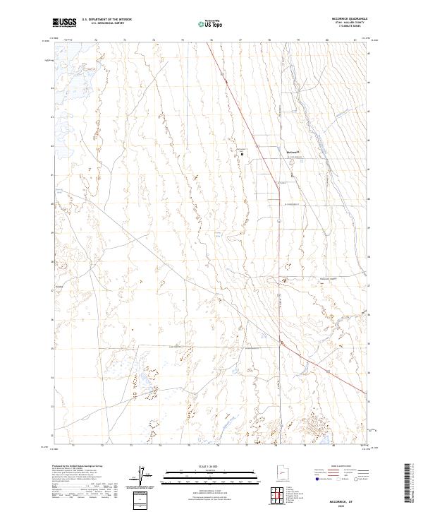
2023 McCornick
Millard County, UT
2023 Middle Mountain
Millard County, UT
2023 Miller Cove
Millard County, UT
2023 Mormon Gap
Millard County, UT
2023 Mount Catherine
Millard County, UT
2023 Needle Point
Millard County, UT
2023 Needle Point Spring
Millard County, UT
2023 Neels
Millard County, UT
2023 North Knoll Spring
Millard County, UT
2023 Notch Peak
Millard County, UT
2023 Oak City North
Millard County, UT
2023 Oak City South
Millard County, UT
2023 Pahvant Butte North
Millard County, UT
2023 Pahvant Butte South
Millard County, UT
2023 Pine Valley Hardpan North
Millard County, UT
2023 Pot Mountain
Millard County, UT
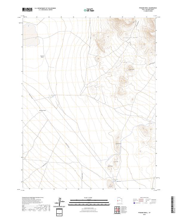
2023 Pyramid Knoll
Millard County, UT
2023 Red Knolls
Millard County, UT
2023 Red Pass
Millard County, UT
2023 Red Ridge
Millard County, UT
2023 Red Rock Knoll
Millard County, UT
2023 Red Tops
Millard County, UT
2023 Rocky Knoll
Millard County, UT
2023 Sand Ridge
Millard County, UT
2023 Scipio Lake
Millard County, UT
2023 Scipio Pass
Millard County, UT
2023 Scipio South
Millard County, UT
2023 Sevier Lake NE
Millard County, UT
2023 Sevier Lake SW
Millard County, UT
2023 Sixmile Point
Millard County, UT
2023 Skull Rock Pass
Millard County, UT
2023 Smelter Knolls East
Millard County, UT
2023 Smelter Knolls West
Millard County, UT
2023 Spring Mountain
Millard County, UT
2023 Strong
Millard County, UT
2023 Sunset Peak
Millard County, UT
2023 Sunstone Knoll
Millard County, UT
2023 Swasey Peak
Millard County, UT
2023 Swasey Peak NW
Millard County, UT
2023 Swasey Peak SW
Millard County, UT
2023 Tabernacle Hill
Millard County, UT
2023 The Barn
Millard County, UT
2023 The Sink
Millard County, UT
2023 Thompson Knoll
Millard County, UT
2023 Tunnel Spring
Millard County, UT
2023 Warm Point
Millard County, UT
2023 Whirlwind Valley NW
Millard County, UT
2023 Whirlwind Valley SW
Millard County, UT
2023 Williams Peak
Millard County, UT