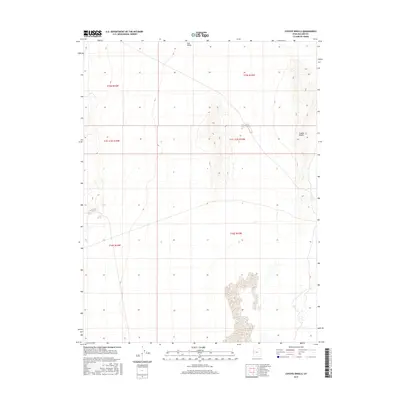
2017 Map of Coyote Knolls
USGS Topo · Published 2017About this map
Tule Valley defines the expansive landscape of this Millard County interior, a region dominated by desert basins and subtle elevation shifts. The survey centers on the prominent Coyote Knolls, which rise distinctly above the valley floor in the eastern portion of the map. This terrain illustrates the characteristic Basin and Range geography of western Utah, where isolated landforms like the knolls serve as primary landmarks across an otherwise open expanse. The absence of modern development or road networks highlight the area's isolation, making it a critical reference for understanding the natural topography and the historical land divisions of the Public Land Survey System, including sections within t15s r15w and t16s r15w.
Find a feature on this map
8 named features on this map. Tap any name to fly to it.
Don’t see what you’re looking for? This feature index may not catch every label — zoom into the map to look around manually.
Map Details
Editions of this 2017 Coyote Knolls Map
This is the sole edition of this map. No revisions or reprints were ever made.
Other maps of this area

1908 · Fish Springs
USGS Topo · 1:250,000

1910 · Fish Springs
USGS Topo · 1:250,000

1953 · Delta
USGS Topo · 1:250,000

1958 · Delta
USGS Topo · 1:250,000

1959 · Cowboy Pass
USGS Topo · 1:62,500

1960 · Granite Mountain
USGS Topo · 1:62,500

1962 · Delta
USGS Topo · 1:250,000

1967 · Sand Pass
USGS Topo · 1:24,000

1972 · Swasey Peak SW
USGS Topo · 1:24,000
1972 · Swasey Peak NW
USGS Topo · 1:24,000