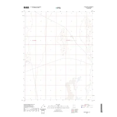
2023 Map of Coyote Knolls
USGS Topo · Published 2023About this map
Tule Valley defines the lower-elevation landscape of this Millard County region, characterized by its wide, open basin and interior drainage patterns. This 2023 survey by the U.S. Geological Survey focuses on the central terrain of the valley, where the prominent Coyote Knolls rise from the desert floor. The map precisely delineates the Public Land Survey System grids, showing the intersection of t15.5s r16w and t15.5s r15w. These knolls provide significant topographic relief in an otherwise flat expanse, serving as essential landmarks for navigation and land management in a sparsely settled part of the Great Basin.
Find a feature on this map
4 named features on this map. Tap any name to fly to it.
Don’t see what you’re looking for? This feature index may not catch every label — zoom into the map to look around manually.
Map Details
Editions of this 2023 Coyote Knolls Map
This is the sole edition of this map. No revisions or reprints were ever made.
Other maps of this area

1908 · Fish Springs
USGS Topo · 1:250,000

1910 · Fish Springs
USGS Topo · 1:250,000

1953 · Delta
USGS Topo · 1:250,000

1958 · Delta
USGS Topo · 1:250,000

1959 · Cowboy Pass
USGS Topo · 1:62,500

1960 · Granite Mountain
USGS Topo · 1:62,500

1962 · Delta
USGS Topo · 1:250,000

1967 · Sand Pass
USGS Topo · 1:24,000

1972 · Swasey Peak SW
USGS Topo · 1:24,000
1972 · Swasey Peak NW
USGS Topo · 1:24,000