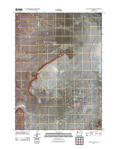
2011 Map of Coyote Lake West
USGS Topo · Published 2011About this map
Coyote Lake defines the eastern edge of this arid high-desert landscape in Malheur County, where the seasonal waters of the Alvord Basin meet the expansive level terrain known as The Flats. This 2011 survey captures the minimal but vital water resources of the region, including the Lower Willow Creek Waterhole in the southwestern corner. The mapping detail highlights a network of ephemeral stream beds and dry washes that characterize this remote drainage system, illustrating how water—even when intermittent—dictates the geography of the Oregon desert. Sparse and specialized, the features here reveal a landscape shaped by extreme evaporation and seasonal run-off, offering a clear record of the basin's hydrology and landform patterns during the early 21st century.
Find a feature on this map
3 named features on this map. Tap any name to fly to it.
Don’t see what you’re looking for? This feature index may not catch every label — zoom into the map to look around manually.
Map Details
Editions of this 2011 Coyote Lake West Map
This is the sole edition of this map. No revisions or reprints were ever made.
Other maps of this area

1955 · Adel
USGS Topo · 1:250,000

1957 · Adel
USGS Topo · 1:250,000

1958 · Adel
USGS Topo · 1:250,000

1962 · Adel
USGS Topo · 1:250,000

1981 · Coyote Lake West
USGS Topo · 1:24,000
1981 · Grassy Ridge Well
USGS Topo · 1:24,000
1981 · Coyote Lake East
USGS Topo · 1:24,000
1981 · Twelvemile Ridge
USGS Topo · 1:24,000

1981 · Tule Springs NE
USGS Topo · 1:24,000

1981 · Ancient Lake Well
USGS Topo · 1:24,000