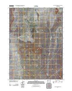
2011 Map of Coyote Meadows
USGS Topo · Published 2011About this map
Coyote Meadows anchors this high-desert landscape in southeastern Oregon, where a network of ephemeral drainages carves through a remote basin. The terrain is defined by the prominent Twin Buttes to the northeast, overseeing a complex hydraulic system including Whitehorse Creek, Antelope Creek, and Twelvemile Creek. This 2011 survey captures the area’s ranching character through a sparse road network that connects the namesake meadows to the surrounding drainages like Fish Creek. The map reflects the vast, open spaces of Malheur County, where water sources and topographic landmarks dictate the movement of people and livestock across the sagebrush-covered plains.
Find a feature on this map
6 named features on this map. Tap any name to fly to it.
Don’t see what you’re looking for? This feature index may not catch every label — zoom into the map to look around manually.
Map Details
Editions of this 2011 Coyote Meadows Map
This is the sole edition of this map. No revisions or reprints were ever made.
Other maps of this area

1955 · Adel
USGS Topo · 1:250,000

1957 · Adel
USGS Topo · 1:250,000

1958 · Adel
USGS Topo · 1:250,000

1962 · Adel
USGS Topo · 1:250,000

1981 · Coyote Lake West
USGS Topo · 1:24,000
1981 · Coyote Lake East
USGS Topo · 1:24,000
1981 · Twelvemile Ridge
USGS Topo · 1:24,000

1981 · Tule Springs NE
USGS Topo · 1:24,000

1981 · Miranda Flat SE
USGS Topo · 1:24,000
1981 · Dry Creek Bench
USGS Topo · 1:24,000