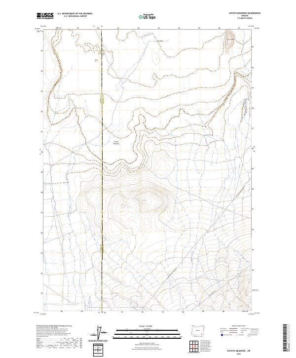
2023 Map of Coyote Meadows
USGS Topo · Published 2023About this map
Coyote Meadows and the surrounding high desert terrain define this remote boundary landscape between Harney and Malheur counties. The area is characterized by a network of seasonal watercourses, including Antelope Creek, Twelvemile Creek, and Whitehorse Creek, which trace their way through the basin. These drainages converge in a land largely defined by topographic extremes, from the low-lying expanse of The Flats to the prominent rising peaks of Twin Buttes.
Find a feature on this map
14 named features on this map. Tap any name to fly to it.
Don’t see what you’re looking for? This feature index may not catch every label — zoom into the map to look around manually.
Map Details
Editions of this 2023 Coyote Meadows Map
This is the sole edition of this map. No revisions or reprints were ever made.
Other maps of this area

1955 · Adel
USGS Topo · 1:250,000

1957 · Adel
USGS Topo · 1:250,000

1958 · Adel
USGS Topo · 1:250,000

1962 · Adel
USGS Topo · 1:250,000

1981 · Coyote Lake West
USGS Topo · 1:24,000
1981 · Coyote Lake East
USGS Topo · 1:24,000
1981 · Twelvemile Ridge
USGS Topo · 1:24,000

1981 · Tule Springs NE
USGS Topo · 1:24,000

1981 · Miranda Flat SE
USGS Topo · 1:24,000
1981 · Dry Creek Bench
USGS Topo · 1:24,000