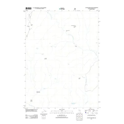
2011 Map of Coyote Mountain
USGS Topo · Published 2011About this map
Coyote Mountain and the surrounding high desert terrain define this corner of Humboldt County, where the North Fork Little Humboldt River carves through the landscape. The map reveals a region defined by water scarcity and cattle ranching history, evidenced by the numerous named water sources like Frog Spring, Pond Spring, and Stewart Spring. Evidence of human presence is sparse, concentrated at the Black Ridge Cabin and the Guard Corral Reservior, showing how early settlers and ranchers managed the arid environment.
Find a feature on this map
23 named features on this map. Tap any name to fly to it.
Don’t see what you’re looking for? This feature index may not catch every label — zoom into the map to look around manually.
Map Details
Editions of this 2011 Coyote Mountain Map
This is the sole edition of this map. No revisions or reprints were ever made.
Other maps of this area

1882 · Paradise
USGS Topo · 1:250,000

1893 · Paradise
USGS Topo · 1:250,000

1955 · McDermitt
USGS Topo · 1:250,000

1959 · McDermitt
USGS Topo · 1:250,000

1980 · Capitol Peak
USGS Topo · 1:24,000

1980 · Black Ridge
USGS Topo · 1:24,000

1980 · Greeley Flat
USGS Topo · 1:24,000

1980 · Hardscrabble
USGS Topo · 1:24,000

1980 · Spring City
USGS Topo · 1:24,000
1980 · Maiden Butte
USGS Topo · 1:24,000