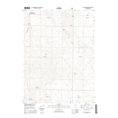
2015 Map of Coyote Mountain
USGS Topo · Published 2015About this map
Humboldt National Forest lands dominate this high-desert landscape in northern Nevada, where water remains the primary driver of geography and nomenclature. A dense network of springs—including Frog Spring, Stewart Spring, and Willow Spring—dots the canyons and basins, supporting the local livestock and wildlife economy. The topography is defined by significant elevations like Coyote Mtn and the Calico Mountains, which overlook expansive grazing areas such as Coon Corrals Flat and Coyote Flat.
Find a feature on this map
35 named features on this map. Tap any name to fly to it.
Don’t see what you’re looking for? This feature index may not catch every label — zoom into the map to look around manually.
Map Details
Editions of this 2015 Coyote Mountain Map
This is the sole edition of this map. No revisions or reprints were ever made.
Other maps of this area

1882 · Paradise
USGS Topo · 1:250,000

1893 · Paradise
USGS Topo · 1:250,000

1955 · McDermitt
USGS Topo · 1:250,000

1959 · McDermitt
USGS Topo · 1:250,000

1980 · Capitol Peak
USGS Topo · 1:24,000

1980 · Black Ridge
USGS Topo · 1:24,000

1980 · Greeley Flat
USGS Topo · 1:24,000

1980 · Hardscrabble
USGS Topo · 1:24,000

1980 · Spring City
USGS Topo · 1:24,000
1980 · Maiden Butte
USGS Topo · 1:24,000