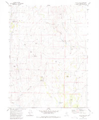
1980 Map of Coyote Mtn.
USGS Topo · Published 1980About this map
Coyote Mountain dominates this portion of the Calico Mountains, where the landscape is marked by the high-desert drainages of Young Canyon and Charlie Young Canyon. The presence of the Charlie Young Goat Corral (Site) and Coon Corrals suggests a history of livestock grazing in these basins, while the Black Ridge Cabin within the Humboldt National Forest points toward early seasonal habitation. Water is the primary driver of life here, documented by numerous named sources like Willow Spring, Frog Spring, and the Guard Corral Reservoir. To the east, the Humboldt River flows through Coyote Flat, providing a contrast to the higher elevations of Zymns Butte and Wildcat Hill. The network of Jeep Trails and a prominent Pipeline indicate the modern infrastructure laid over this traditional rangeland.
Find a feature on this map
33 named features on this map. Tap any name to fly to it.
Don’t see what you’re looking for? This feature index may not catch every label — zoom into the map to look around manually.
Map Details
Editions of this 1980 Coyote Mtn. Map
This is the sole edition of this map. No revisions or reprints were ever made.
Other maps of this area

1882 · Paradise
USGS Topo · 1:250,000

1893 · Paradise
USGS Topo · 1:250,000

1955 · McDermitt
USGS Topo · 1:250,000

1959 · McDermitt
USGS Topo · 1:250,000

1980 · Capitol Peak
USGS Topo · 1:24,000

1980 · Black Ridge
USGS Topo · 1:24,000

1980 · Greeley Flat
USGS Topo · 1:24,000

1980 · Hardscrabble
USGS Topo · 1:24,000

1980 · Spring City
USGS Topo · 1:24,000
1980 · Maiden Butte
USGS Topo · 1:24,000