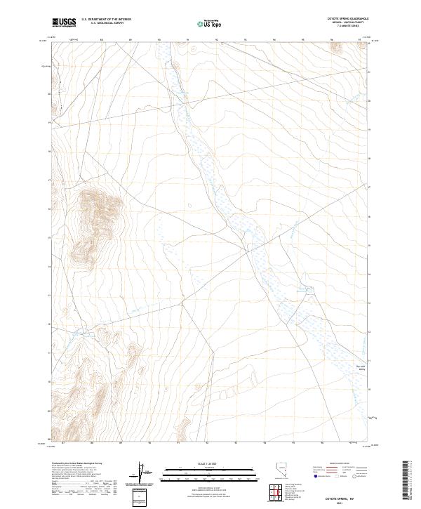
2021 Map of Coyote Spring
USGS Topo · Published 2021About this map
Coyote Spring and its surrounding desert topography define this portion of Lincoln County, where water sources dictated the movement of both people and livestock. The expansive corridor of Coyote Wash dominates the central landscape, acting as a natural drainage artery that flows toward the south. This modern survey illustrates the persistent importance of isolated water points in the Great Basin, highlighting features like Stonewall Spring and the Upper Reservoir that anchor the otherwise arid terrain. To the southeast, the geography transitions into the broad expanse of Dry Lake Valley, a characteristic desert sink. The map provides a detailed view of the ephemeral water systems of the region, including Silverhorn Wash and Fairview Wash, showing how these intermittent flows have shaped the basin floor over time.
Find a feature on this map
12 named features on this map. Tap any name to fly to it.
Don’t see what you’re looking for? This feature index may not catch every label — zoom into the map to look around manually.
Map Details
Editions of this 2021 Coyote Spring Map
This is the sole edition of this map. No revisions or reprints were ever made.
Other maps of this area

1885 · Pioche
USGS Topo · 1:250,000

1886 · Pioche
USGS Topo · 1:250,000

1915 · Bristol Range
USGS Topo · 1:62,500

1916 · Highland
USGS Topo · 1:62,500

1917 · Bristol Range
USGS Topo · 1:62,500

1918 · Highland
USGS Topo · 1:62,500

1954 · Caliente
USGS Topo · 1:250,000

1956 · Lund
USGS Topo · 1:250,000

1959 · Caliente
USGS Topo · 1:250,000

1960 · Lund
USGS Topo · 1:250,000