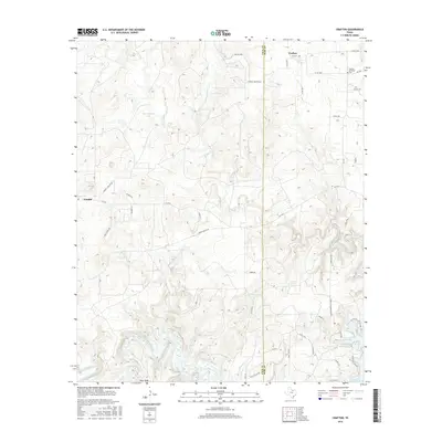
2016 Map of Crafton
USGS Topo · Published 2016About this map
Crafton and Cundiff anchor this landscape along the Jack Co and Wise Co line, where the prairie begins its descent toward the drainage basins of the West Fork Trinity River. The topography is defined by the winding paths of Big Cr and Elm Cr, which feed into the northern reaches of Lake Bridgeport. This 2016 survey illustrates a rural Texas environment where water management and ranching legacy are central, evidenced by named features like Cherryhomes Lake, Grace Lake, and the sprawling network of county roads such as Cundiff Crafton Rd.
Find a feature on this map
46 named features on this map. Tap any name to fly to it.
Don’t see what you’re looking for? This feature index may not catch every label — zoom into the map to look around manually.
Map Details
Editions of this 2016 Crafton Map
This is the sole edition of this map. No revisions or reprints were ever made.
Other maps of this area

1954 · Sherman
USGS Topo · 1:250,000

1954 · Wichita Falls
USGS Topo · 1:250,000

1958 · Wichita Falls
USGS Topo · 1:250,000

1958 · Sherman
USGS Topo · 1:250,000

1960 · Bridgeport West
USGS Topo · 1:24,000

1960 · Wizard Wells
USGS Topo · 1:24,000

1961 · Selma
USGS Topo · 1:24,000

1961 · Jacksboro NE
USGS Topo · 1:24,000

1961 · Sunset
USGS Topo · 1:24,000

1961 · Crafton
USGS Topo · 1:24,000