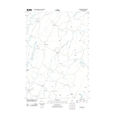
2012 Map of Craftsbury
USGS Topo · Published 2012About this map
The Black River flows northward through this Orleans County landscape, anchoring a series of small settlements including Craftsbury, East Craftsbury, and South Albany. The distribution of burial grounds such as Albany Center Cem and the Catholic Cem at Merrill Corner suggests a long-standing community structure organized around these crossroads. The terrain is defined by a sequence of named heights, including Holiday Hill, Ames Hill, and Miles Hill, which direct the flow of numerous small tributaries like Whitney Brook and Whetstone Brook. Recreation is evident at Great Hosmer Pond and Little Hosmer Pond, where the presence of Holiday Hill Camp points to the area's role as a seasonal destination. Farther east, the cluster of Gebbie Corner and the secluded Long Pond reflect the rural character of the Vermont uplands in the early twenty-first century.
Find a feature on this map
109 named features on this map. Tap any name to fly to it.
Don’t see what you’re looking for? This feature index may not catch every label — zoom into the map to look around manually.
Map Details
Editions of this 2012 Craftsbury Map
This is the sole edition of this map. No revisions or reprints were ever made.
Other maps of this area

1919 · Lake Memphremagog
USGS Topo · 1:62,500

1920 · Derby
USGS Topo · 1:62,500

1920 · Irasburg
USGS Topo · 1:62,500

1923 · Irasburg
USGS Topo · 1:48,000

1923 · Lake Memphremagog
USGS Topo · 1:48,000

1925 · Irasburg
USGS Topo · 1:62,500

1925 · Memphremagog
USGS Topo · 1:62,500

1928 · Hardwick
USGS Topo · 1:62,500

1934 · Hardwick
USGS Topo · 1:48,000

1935 · Lyndonville
USGS Topo · 1:48,000