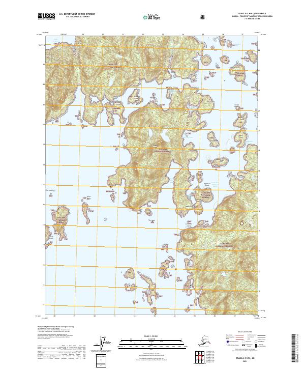
2021 Map of Craig A-3 NW
USGS Topo · Published 2021About this map
Goat Island and a dense archipelago of named landforms dominate this coastal portion of the Tongass National Forest. The intricate shoreline is defined by the South Pass Sukkwan Strait and the constricted Sukkwan Narrows, which separate numerous islands and islets. Navigation and local geography are recorded through descriptive names such as Crab Trap Cove, Fishhook Island, and Whisker Point. To the north, Soda Bay and Natzuhini Bay carve into the heavily indented coast, while features like Deadman Island and Spook Island suggest a long history of maritime activity and local lore. This modern survey provides a precise look at the complex interface of land and water in Southeast Alaska, documenting the position of markers like Turn Rock and The Sentinels within the vast national forest boundary.
Find a feature on this map
36 named features on this map. Tap any name to fly to it.
Don’t see what you’re looking for? This feature index may not catch every label — zoom into the map to look around manually.
Map Details
Editions of this 2021 Craig A-3 NW Map
This is the sole edition of this map. No revisions or reprints were ever made.
Other maps of this area

1948 · Craig A-4
USGS Topo · 1:63,360

1948 · Craig A-3
USGS Topo · 1:63,360

1949 · Craig B-3
USGS Topo · 1:63,360

1949 · Craig B-4
USGS Topo · 1:63,360

1951 · Craig B-4
USGS Topo · 1:63,360

1951 · Craig B-3
USGS Topo · 1:63,360

1951 · Craig A-4
USGS Topo · 1:63,360

1951 · Craig A-3
USGS Topo · 1:63,360

1957 · Craig
USGS Topo · 1:250,000
1994 · Craig A-4
USGS Topo · 1:63,360