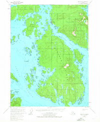
1951 Map of Craig A-3
USGS Topo · Published 1967About this map
Hydaburg stands as the primary settlement on this portion of the Alexander Archipelago, situated along the Sukkwan Narrows between Prince of Wales Island and Sukkwan Island. The map illustrates a coastal infrastructure tied to the sea, featuring an Aqueduct north of the town and a Cem on the nearby shoreline. The intricate waterways of Sukkwan Strait, Dunbar Inlet, and Hetta Inlet define the landscape, revealing the complex navigation routes used by local residents and the fishing industry in the mid-20th century.
Find a feature on this map
41 named features on this map. Tap any name to fly to it.
Don’t see what you’re looking for? This feature index may not catch every label — zoom into the map to look around manually.
Map Details
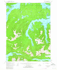
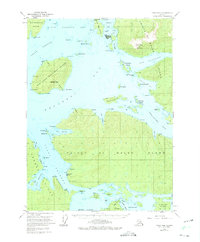
Editions of this 1951 Craig A-3 Map
3 editions found


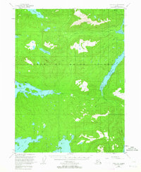
Other maps of this area

1948 · Craig A-4
USGS Topo · 1:63,360

1948 · Dixon Entrance D-2
USGS Topo · 1:63,360

1948 · Dixon Entrance D-4
USGS Topo · 1:63,360

1948 · Dixon Entrance D-3
USGS Topo · 1:63,360

1948 · Craig A-3
USGS Topo · 1:63,360

1948 · Craig A-2
USGS Topo · 1:63,360
1949 · Craig B-2
USGS Topo · 1:63,360
1949 · Craig B-3
USGS Topo · 1:63,360
1949 · Craig B-4
USGS Topo · 1:63,360

1951 · Craig B-2
USGS Topo · 1:63,360