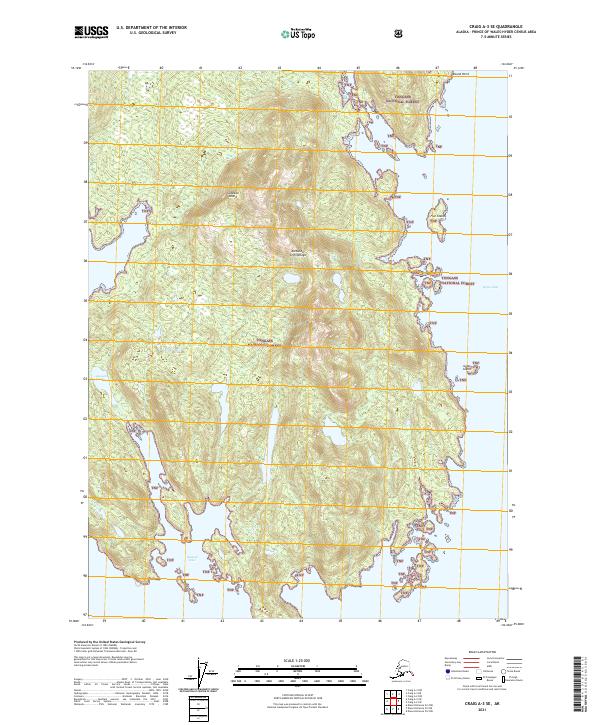
2021 Map of Craig A-3 SE
USGS Topo · Published 2021About this map
Sukkwan Island, a significant landmass within the Alexander Archipelago, dominates this coastal survey of the Tongass National Forest. The map illustrates a complex shoreline where the Pacific waters meet the dense forest, notably at Kasook Inlet and Hetta Inlet. Inland, the geography is defined by the freshwater Kasook Lake, surrounded by steep topographic contours that characterize this portion of Southeast Alaska. This maritime landscape is punctuated by several navigational landmarks, including Round Point and smaller islands such as Flat Island and Grass Island. The absence of roads or established settlements on this sheet reflects the wilderness character of the region, emphasizing the importance of natural waterways for movement and resource management within the forest boundaries.
Find a feature on this map
16 named features on this map. Tap any name to fly to it.
Don’t see what you’re looking for? This feature index may not catch every label — zoom into the map to look around manually.
Map Details
Editions of this 2021 Craig A-3 SE Map
This is the sole edition of this map. No revisions or reprints were ever made.
Other maps of this area

1948 · Dixon Entrance D-2
USGS Topo · 1:63,360

1948 · Dixon Entrance D-3
USGS Topo · 1:63,360

1948 · Craig A-3
USGS Topo · 1:63,360

1948 · Craig A-2
USGS Topo · 1:63,360

1951 · Dixon Entrance
USGS Topo · 1:250,000

1951 · Dixon Entrance D-3
USGS Topo · 1:63,360

1951 · Dixon Entrance D-2
USGS Topo · 1:63,360

1951 · Craig A-2
USGS Topo · 1:63,360

1951 · Craig A-3
USGS Topo · 1:63,360

1957 · Craig
USGS Topo · 1:250,000