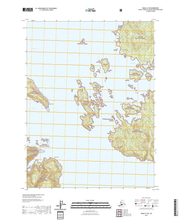
2021 Map of Craig A-3 SW
USGS Topo · Published 2021About this map
Dall Island and the rugged archipelago of the Tongass National Forest dominate this maritime survey of the Prince of Wales-Hyder Census Area. The landscape is defined by a complex network of coastal features, from the deep waters of Tlevak Strait to sheltered inlets like View Cove and Baldy Bay. The presence of numerous small island groups, such as the McFarland Islands, Profit Island, and Reef Island, illustrates the intricate navigational challenges of these Alaskan waters. Landforms like Kellogg Point, Reef Point, and High Point serve as key landmarks for mariners along the shoreline. This study provides a detailed view of the natural topography and nautical landmarks before further modern development, capturing the essential character of this secluded coastal environment.
Find a feature on this map
18 named features on this map. Tap any name to fly to it.
Don’t see what you’re looking for? This feature index may not catch every label — zoom into the map to look around manually.
Map Details
Editions of this 2021 Craig A-3 SW Map
This is the sole edition of this map. No revisions or reprints were ever made.
Other maps of this area

1948 · Craig A-4
USGS Topo · 1:63,360

1948 · Dixon Entrance D-4
USGS Topo · 1:63,360

1948 · Dixon Entrance D-3
USGS Topo · 1:63,360

1948 · Craig A-3
USGS Topo · 1:63,360

1951 · Dixon Entrance
USGS Topo · 1:250,000

1951 · Dixon Entrance D-3
USGS Topo · 1:63,360

1951 · Craig A-4
USGS Topo · 1:63,360

1951 · Craig A-3
USGS Topo · 1:63,360
1951 · Dixon Entrance D-4
USGS Topo · 1:63,360

1957 · Craig
USGS Topo · 1:250,000