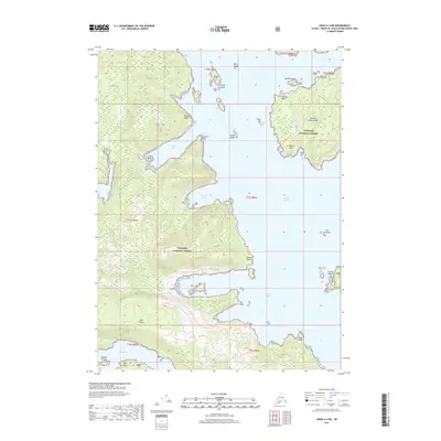
2017 Map of Craig A-4 NE
USGS Topo · Published 2017About this map
Tongass National Forest encompasses the majority of the land shown in this 2017 survey, spanning the intricate maritime geography between Prince of Wales Island and Dall Island. The map documents a complex coastline defined by deep inlets and hazardous points of land, including Halibut Nose and Hassler Point. Separating these major landmasses is the Tlevak Strait, a waterway dotted with small island groups like The Sentinels and the Nichols Islands.
Find a feature on this map
29 named features on this map. Tap any name to fly to it.
Don’t see what you’re looking for? This feature index may not catch every label — zoom into the map to look around manually.
Map Details
Editions of this 2017 Craig A-4 NE Map
This is the sole edition of this map. No revisions or reprints were ever made.
Other maps of this area

1948 · Craig A-4
USGS Topo · 1:63,360

1948 · Craig A-3
USGS Topo · 1:63,360

1949 · Craig B-3
USGS Topo · 1:63,360

1949 · Craig B-4
USGS Topo · 1:63,360

1951 · Craig B-4
USGS Topo · 1:63,360

1951 · Craig B-3
USGS Topo · 1:63,360

1951 · Craig A-4
USGS Topo · 1:63,360

1951 · Craig A-3
USGS Topo · 1:63,360

1957 · Craig
USGS Topo · 1:250,000
1994 · Craig A-4
USGS Topo · 1:63,360