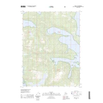
2023 Map of Craig A-4 SE
USGS Topo · Published 2023About this map
Tongass National Forest covers this coastal stretch of the Alexander Archipelago, where steep mountain peaks rise directly from protected inlets and harbors. This survey captures a landscape defined by significant elevations, including the prominent Hiilaang Tsuuujuus Mtn and White Mtn, which overlook a complex network of waterways. The shoreline is carved into distinct maritime features such as Manhattan Arm, Coco Harbor, and View Cove, while smaller landmarks like Clam Island and Black Rock provide essential navigation points within the sounds. Inland, the terrain is dominated by dense contouring that descends toward Devil Lake, illustrating the dramatic relief characteristic of this part of Prince of Wales Island. The map provides a precise record of these natural features and established boundaries like t78s r82e, useful for understanding the geographical layout of this coastal wilderness.
Find a feature on this map
18 named features on this map. Tap any name to fly to it.
Don’t see what you’re looking for? This feature index may not catch every label — zoom into the map to look around manually.
Map Details
Editions of this 2023 Craig A-4 SE Map
This is the sole edition of this map. No revisions or reprints were ever made.
Other maps of this area

1948 · Craig A-4
USGS Topo · 1:63,360

1948 · Dixon Entrance D-4
USGS Topo · 1:63,360

1948 · Dixon Entrance D-3
USGS Topo · 1:63,360

1948 · Craig A-3
USGS Topo · 1:63,360

1951 · Dixon Entrance
USGS Topo · 1:250,000

1951 · Dixon Entrance D-3
USGS Topo · 1:63,360

1951 · Craig A-4
USGS Topo · 1:63,360

1951 · Craig A-3
USGS Topo · 1:63,360
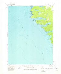
1951 · Dixon Entrance D-4
USGS Topo · 1:63,360

1957 · Craig
USGS Topo · 1:250,000