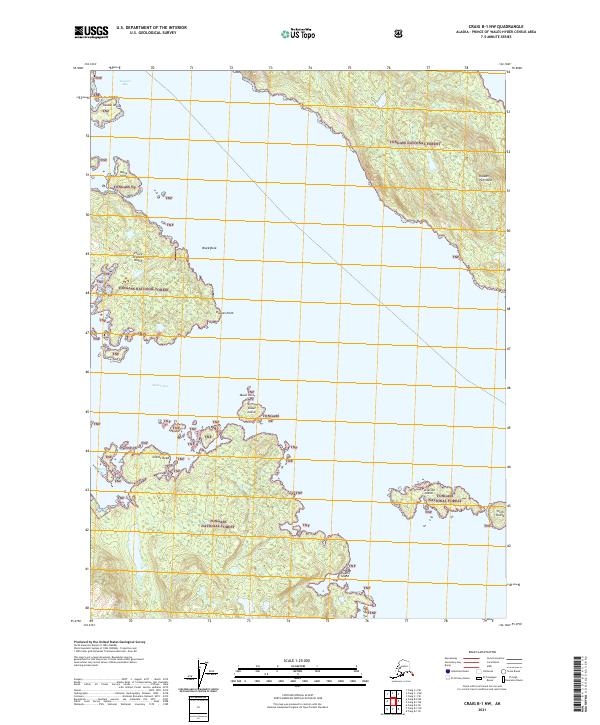
2021 Map of Craig B-1 NW
USGS Topo · Published 2021About this map
Tongass National Forest dominates this coastal survey of the Alexander Archipelago, where the complex shoreline of Prince of Wales Island meets the waters of Kasaan Bay and Skowl Arm. The landscape is a maze of wooded islands and rocky outcroppings, featuring landmarks such as Kasaan Island, Daisy Island, and the prominent Giants Head point. The intricate coastline includes narrow passages and inlets, including Skowl Island and Patterson Island, illustrating the maritime character of the Kasaan Peninsula region. This map provides a clear view of the public land survey system grid, designated by township and range lines like t74s r86e, overlaid upon a wilderness area defined by its island geography and protected forest lands.
Find a feature on this map
23 named features on this map. Tap any name to fly to it.
Don’t see what you’re looking for? This feature index may not catch every label — zoom into the map to look around manually.
Map Details
Editions of this 2021 Craig B-1 NW Map
This is the sole edition of this map. No revisions or reprints were ever made.
Other maps of this area

1949 · Craig C-2
USGS Topo · 1:63,360

1949 · Craig B-2
USGS Topo · 1:63,360

1949 · Craig B-1
USGS Topo · 1:63,360

1950 · Craig B-1
USGS Topo · 1:63,360

1950 · Craig C-1
USGS Topo · 1:63,360

1951 · Craig B-2
USGS Topo · 1:63,360

1951 · Craig C-2
USGS Topo · 1:63,360

1951 · Craig C-1
USGS Topo · 1:63,360

1957 · Craig
USGS Topo · 1:250,000
1994 · Craig C-2
USGS Topo · 1:63,360