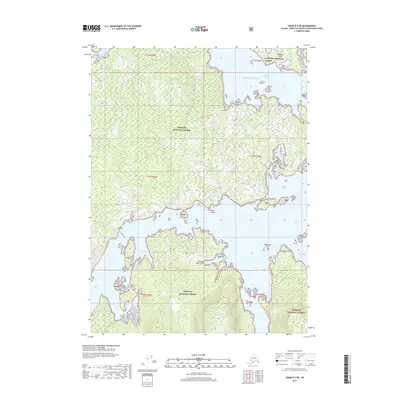
2017 Map of Craig B-2 NE
USGS Topo · Published 2017About this map
Tongass National Forest encompasses the majority of this coastal landscape on Prince of Wales Island, defined by its intricate network of saltwater inlets and forested ridges. The topography is dominated by the deep waters of Kasaan Bay and the Skowl Arm, which frame a series of rugged peninsulas and islands. Along the northern coast, Kasaan Island stands near the opening of Smith Lagoon, while the southern reaches are marked by the sheltered waters of Polk Inlet and Goose Bay.
Find a feature on this map
32 named features on this map. Tap any name to fly to it.
Don’t see what you’re looking for? This feature index may not catch every label — zoom into the map to look around manually.
Map Details
Editions of this 2017 Craig B-2 NE Map
This is the sole edition of this map. No revisions or reprints were ever made.
Other maps of this area

1949 · Craig C-2
USGS Topo · 1:63,360

1949 · Craig B-2
USGS Topo · 1:63,360

1949 · Craig B-1
USGS Topo · 1:63,360

1950 · Craig B-1
USGS Topo · 1:63,360

1950 · Craig C-1
USGS Topo · 1:63,360

1951 · Craig B-2
USGS Topo · 1:63,360

1951 · Craig C-2
USGS Topo · 1:63,360

1951 · Craig C-1
USGS Topo · 1:63,360

1957 · Craig
USGS Topo · 1:250,000
1994 · Craig C-2
USGS Topo · 1:63,360