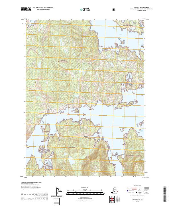
2021 Map of Craig B-2 NE
USGS Topo · Published 2021About this map
The intricate coastal network of Southeast Alaska's Prince of Wales Island is documented in this contemporary survey, where the Tongass National Forest covers much of the land area. The map illustrates a complex geography of inlets and channels, including the protected waters of Polk Inlet and Skowl Arm. Near the northern edge, Kasaan Island sits within Kasaan Bay, while further south, smaller landmarks like West Sentinel Island and East Sentinel Island guide navigation. Significant freshwater features like Ives Lake and drainages such as Hundred Thousand Cr highlight the interior hydrology. The distribution of inlets like Little Goose Bay and Saltery Cove suggests a landscape defined by maritime access, common for the region's historical reliance on seasonal fishing and logging activities within the federal forest boundaries.
Find a feature on this map
32 named features on this map. Tap any name to fly to it.
Don’t see what you’re looking for? This feature index may not catch every label — zoom into the map to look around manually.
Map Details
Editions of this 2021 Craig B-2 NE Map
This is the sole edition of this map. No revisions or reprints were ever made.
Other maps of this area

1949 · Craig C-2
USGS Topo · 1:63,360

1949 · Craig B-2
USGS Topo · 1:63,360

1949 · Craig B-1
USGS Topo · 1:63,360

1950 · Craig B-1
USGS Topo · 1:63,360

1950 · Craig C-1
USGS Topo · 1:63,360

1951 · Craig B-2
USGS Topo · 1:63,360

1951 · Craig C-2
USGS Topo · 1:63,360

1951 · Craig C-1
USGS Topo · 1:63,360

1957 · Craig
USGS Topo · 1:250,000
1994 · Craig C-2
USGS Topo · 1:63,360