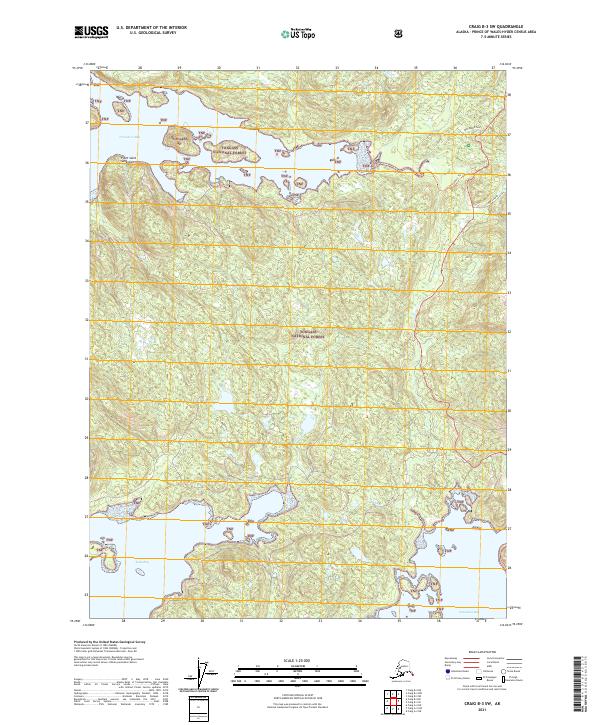
2021 Map of Craig B-3 SW
USGS Topo · Published 2021About this map
Trocadero Bay and its complex, indented shoreline define the northern reach of this coastal landscape within the Tongass National Forest. The 2021 survey reveals a territory dominated by maritime influence, where the tidal environment of Trocadero Flats meets the deep waters of Soda Bay and Natzuhini Bay. Significant landmarks like Point Saint Sebastian navigate the entrance to these protected inlets, which have long served as vital corridors for the region's sea-based economy.
Find a feature on this map
14 named features on this map. Tap any name to fly to it.
Don’t see what you’re looking for? This feature index may not catch every label — zoom into the map to look around manually.
Map Details
Editions of this 2021 Craig B-3 SW Map
This is the sole edition of this map. No revisions or reprints were ever made.
Other maps of this area

1948 · Craig A-4
USGS Topo · 1:63,360

1948 · Craig A-3
USGS Topo · 1:63,360

1949 · Craig B-3
USGS Topo · 1:63,360

1949 · Craig B-4
USGS Topo · 1:63,360

1951 · Craig B-4
USGS Topo · 1:63,360

1951 · Craig B-3
USGS Topo · 1:63,360

1951 · Craig A-4
USGS Topo · 1:63,360

1951 · Craig A-3
USGS Topo · 1:63,360

1957 · Craig
USGS Topo · 1:250,000
1994 · Craig A-4
USGS Topo · 1:63,360