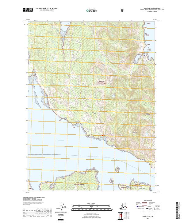
2021 Map of Craig C-2 SE
USGS Topo · Published 2021About this map
The coastal settlement of Kasaan anchors this 2021 study of the eastern shore of Prince of Wales Island. Located along Kasaan Bay, the village is the primary point of human activity on the Kasaan Peninsula, where the Kasaan Road provides the sole overland connection through the heavily forested interior. This landscape is defined by its deep saltwater inlets and protected anchorages like Mills Bay and Widtun Harbor, which reflect the region's long-standing reliance on maritime transport and fishing. The topography rises sharply from the shore to prominent peaks such as Jacobs Mtn and Kasaan Mtn, while interior freshwater bodies like Copper Center Lake and Lindeman Lake sit tucked within the vast boundaries of the Tongass National Forest. The map also details several smaller landforms and points of interest including Sunny Hat Point and the outlying Kasaan Island to the south.
Find a feature on this map
26 named features on this map. Tap any name to fly to it.
Don’t see what you’re looking for? This feature index may not catch every label — zoom into the map to look around manually.
Map Details
Editions of this 2021 Craig C-2 SE Map
This is the sole edition of this map. No revisions or reprints were ever made.
Other maps of this area

1949 · Craig C-2
USGS Topo · 1:63,360

1949 · Craig B-2
USGS Topo · 1:63,360

1949 · Craig B-1
USGS Topo · 1:63,360

1950 · Craig B-1
USGS Topo · 1:63,360

1950 · Craig C-1
USGS Topo · 1:63,360

1951 · Craig B-2
USGS Topo · 1:63,360

1951 · Craig C-2
USGS Topo · 1:63,360

1951 · Craig C-1
USGS Topo · 1:63,360

1957 · Craig
USGS Topo · 1:250,000
1994 · Craig C-2
USGS Topo · 1:63,360