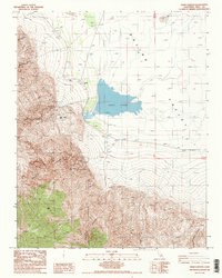
1987 Map of Craig Canyon
USGS Topo · Published 1987About this map
Salt Lake dominates the floor of the Saline Valley, illustrating a landscape defined by extreme evaporation and mineral extraction. This 1987 survey reveals the industrial infrastructure of the basin, including a Salt Evaporator and a network of water sources such as Gervais Well, Flowing Well, and a specialized Well (Salt). These features point to the historical importance of salt harvesting in this arid environment.
Find a feature on this map
22 named features on this map. Tap any name to fly to it.
Don’t see what you’re looking for? This feature index may not catch every label — zoom into the map to look around manually.
Map Details
Editions of this 1987 Craig Canyon Map
2 editions found
Other maps of this area

1908 · Ballarat
USGS Topo · 1:250,000

1913 · Ballarat
USGS Topo · 1:250,000

1948 · Death Valley
USGS Topo · 1:250,000

1950 · New York Butte
USGS Topo · 1:62,500

1950 · Ubehebe Peak
USGS Topo · 1:62,500

1951 · New York Butte
USGS Topo · 1:62,500

1951 · Ubehebe Peak
USGS Topo · 1:62,500

1951 · Waucoba Wash
USGS Topo · 1:62,500

1954 · Death Valley
USGS Topo · 1:250,000

1956 · Death Valley
USGS Topo · 1:250,000