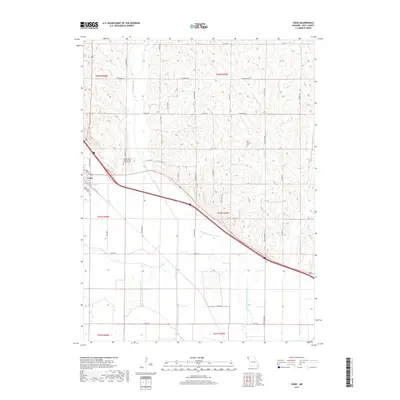
2017 Map of Craig
USGS Topo · Published 2017About this map
The town of Craig anchors this landscape in northwest Missouri, situated at a junction of roads and rail lines as they cut across the drainage basin of the Missouri River. The terrain is defined by the complex hydrology of the Little Tarkio Cr, including the distinctive Old Channel Little Tarkio River and Old Channel Little Tarkio Cr, which reveal the shifting nature of these watercourses over time. Higher ground to the north and east is characterized by deep ravines and ridges accessed by descriptive local routes like Lonesome Rd and Graystone Rd. For those researching local heritage, the map identifies significant burial sites including the Independent Order of Odd Fellows Cem just northeast of town and the more isolated New Liberty Cem positioned among the eastern hills near Wildcat Cr.
Find a feature on this map
41 named features on this map. Tap any name to fly to it.
Don’t see what you’re looking for? This feature index may not catch every label — zoom into the map to look around manually.
Map Details
Editions of this 2017 Craig Map
This is the sole edition of this map. No revisions or reprints were ever made.
Other maps of this area

1920 · Craig
USGS Topo · 1:62,500

1926 · Maitland
USGS Topo · 1:62,500

1936 · Fairfax
USGS Topo · 1:24,000

1939 · Tarkio
USGS Topo · 1:62,500

1939 · Skidmore
USGS Topo · 1:62,500

1940 · Tarkio
USGS Topo · 1:62,500

1941 · Tarkio
USGS Topo · 1:62,500

1941 · Skidmore
USGS Topo · 1:62,500

1942 · Skidmore
USGS Topo · 1:62,500

1955 · Nebraska City
USGS Topo · 1:250,000