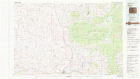
1979 Map of Craig
USGS Topo · Published 1979About this map
Craig serves as the primary hub of this Northwest Colorado landscape, situated along the Yampa River and the industrial corridor of the Denver and Rio Grande Western Railroad. The 1979 survey captures a region defined by its complex drainage systems and extractive industry, where the high desert terrain of Great Divide and Sugarloaf Basin gives way to the densely timbered Routt National Forest. Resource extraction is evident throughout the quadrangle, from the Morgan Creek Mine No 1 and Seymour Mine to several prominent strip mines and quarries.
Find a feature on this map
101 named features on this map. Tap any name to fly to it.
Don’t see what you’re looking for? This feature index may not catch every label — zoom into the map to look around manually.
Map Details
Editions of this 1979 Craig Map
This is the sole edition of this map. No revisions or reprints were ever made.
Other maps of this area

1907 · White River
USGS Topo · 1:125,000

1910 · Danforth Hills
USGS Topo · 1:125,000

1910 · White River
USGS Topo · 1:125,000

1911 · Hahns Peak
USGS Topo · 1:125,000

1912 · Axial
USGS Topo · 1:62,500

1913 · Hahns Peak
USGS Topo · 1:125,000

1914 · Axial
USGS Topo · 1:62,500

1915 · Monument Butte
USGS Topo · 1:62,500

1916 · Craig
USGS Topo · 1:125,000

1916 · Daton Peak
USGS Topo · 1:62,500