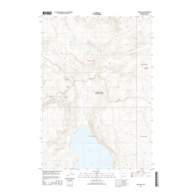
2015 Map of Craig Pass
USGS Topo · Published 2015About this map
Yellowstone National Park terrain is defined by the high-elevation passage of the Continental Divide through Teton County. The central corridor is dominated by the winding Grand Loop Rd, which navigates the topographic challenges of Craig Pass and the distinctive Corkscrew Hill. To the south, the landscape opens into the northern waters of Shoshone Lake, fed by drainage from De Lacy Cr and the smaller White Cr. This 2015 survey illustrates the modern trail and road infrastructure used to navigate the backcountry, including the Delacy Creek Trail and Divide Trail. The map provides a clear look at the hydrologic split of the region, where water bodies like De Lacy Lakes and Teal Lake sit high in the drainage basins near Norris Pass.
Find a feature on this map
24 named features on this map. Tap any name to fly to it.
Don’t see what you’re looking for? This feature index may not catch every label — zoom into the map to look around manually.
Map Details
Editions of this 2015 Craig Pass Map
This is the sole edition of this map. No revisions or reprints were ever made.
Other maps of this area

1885 · Gallatin
USGS Topo · 1:125,000

1885 · Gallatin
USGS Topo · 1:125,000

1886 · Shoshone
USGS Topo · 1:125,000

1888 · Shoshone
USGS Topo · 1:125,000

1895 · Shoshone
USGS Topo · 1:125,000

1901 · Shoshone
USGS Topo · 1:125,000

1901 · Gallatin
USGS Topo · 1:125,000

1908 · Gallatin
USGS Topo · 1:125,000

1908 · Shoshone
USGS Topo · 1:125,000

1911 · Shoshone
USGS Topo · 1:125,000