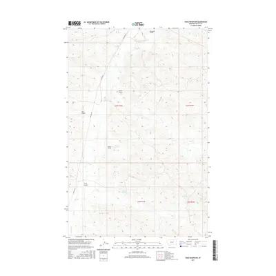
2017 Map of Craig Reservoir
USGS Topo · Published 2017About this map
Larb Cr and its various tributaries define the drainage patterns of this Valley County landscape. The topography is marked by a series of coulees, including Hammond Coulee, Grant Coulee, and Krome Coulee, which channel seasonal runoff toward the larger creek systems. These natural features are supplemented by man-made water management structures such as Korman Reservoir, McCuin Reservoir, and Craig Reservoir, which reflect the region's reliance on water storage for ranching and agriculture. The primary thoroughfare through this territory is Larb Creek Rd, which tracks across the northern and western sections of the map, providing essential access to these remote watersheds and reservoirs. The landscape is characterized by the complex relief between coulees and the more level plains, typical of the Missouri River breaks region.
Find a feature on this map
14 named features on this map. Tap any name to fly to it.
Don’t see what you’re looking for? This feature index may not catch every label — zoom into the map to look around manually.
Map Details
Editions of this 2017 Craig Reservoir Map
This is the sole edition of this map. No revisions or reprints were ever made.
Other maps of this area

1954 · Jordan
USGS Topo · 1:250,000

1954 · Glasgow
USGS Topo · 1:250,000

1956 · Jordan
USGS Topo · 1:250,000

1957 · Glasgow
USGS Topo · 1:250,000

1958 · Glasgow
USGS Topo · 1:250,000

1958 · Jordan
USGS Topo · 1:250,000

1964 · Jordan
USGS Topo · 1:250,000

1973 · Triple Crossing Reservoir West
USGS Topo · 1:24,000

1973 · Niles Coulee
USGS Topo · 1:24,000
1973 · White Horse Coulee
USGS Topo · 1:24,000