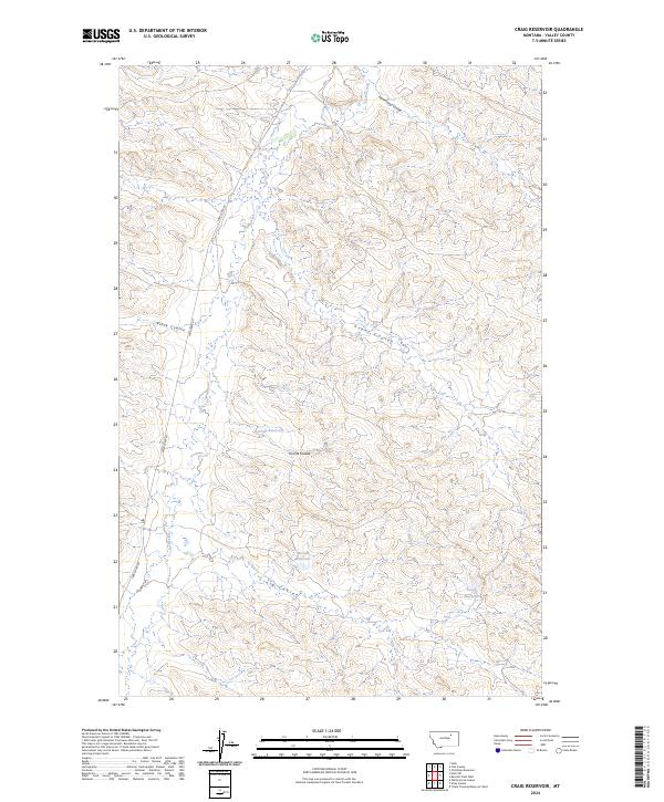
2024 Map of Craig Reservoir
USGS Topo · Published 2024About this map
Larb Creek carves a winding path through the heart of this Valley County landscape, defining a terrain shaped by long, deeply etched drainage systems. This 2024 survey captures the sophisticated water management of this ranching and grazing region, where significant catchments such as Korman Reservoir and the central McCuin Reservoir serve as critical landmarks for local land use. The topography is dominated by a series of prominent coulees—including Black Coulee and Grant Coulee—that illustrate the erosional patterns common to the Montana plains. Running roughly parallel to the primary waterway, Larb Creek Rd provides the singular modern artery through the region, connecting isolated points across the township lines. The presence of Craig Reservoir and the namesake Craig Coulee in the southern reaches highlights the localized naming conventions typical of early land claimants and homesteaders in the area.
Find a feature on this map
14 named features on this map. Tap any name to fly to it.
Don’t see what you’re looking for? This feature index may not catch every label — zoom into the map to look around manually.
Map Details
Editions of this 2024 Craig Reservoir Map
This is the sole edition of this map. No revisions or reprints were ever made.
Other maps of this area

1954 · Jordan
USGS Topo · 1:250,000

1954 · Glasgow
USGS Topo · 1:250,000

1956 · Jordan
USGS Topo · 1:250,000

1957 · Glasgow
USGS Topo · 1:250,000

1958 · Glasgow
USGS Topo · 1:250,000

1958 · Jordan
USGS Topo · 1:250,000

1964 · Jordan
USGS Topo · 1:250,000

1973 · Triple Crossing Reservoir West
USGS Topo · 1:24,000

1973 · Niles Coulee
USGS Topo · 1:24,000
1973 · White Horse Coulee
USGS Topo · 1:24,000