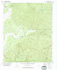
1971 Map of Crandall
USGS Topo · Published 1984About this map
Crandall and its relationship to the Louisville and Nashville railroad define the western edge of this 1971 survey, while the rugged interior of the Chattahoochee National Forest dominates the east. The landscape transitions from the rail-serviced valley into high mountain elevations, reaching landmarks like Bald Mtn and Grassy Mtn, the latter featuring a dedicated Lookout Tower.
Find a feature on this map
49 named features on this map. Tap any name to fly to it.
Don’t see what you’re looking for? This feature index may not catch every label — zoom into the map to look around manually.
Map Details
Editions of this 1971 Crandall Map
Other maps of this area

1886 · Dalton
USGS Topo · 1:125,000

1892 · Dalton
USGS Topo · 1:125,000

1897 · Dalton
USGS Topo · 1:125,000

1911 · Cohutta Mtn
USGS Topo · 1:62,500

1913 · Cohutta Mtn.
USGS Topo · 1:62,500

1914 · Talking Rock
USGS Topo · 1:62,500

1916 · Talking Rock
USGS Topo · 1:62,500
1935 · Hemp Top
USGS Topo · 1:24,000

1938 · Chatsworth
USGS Topo · 1:48,000

1943 · Dalton
USGS Topo · 1:62,500