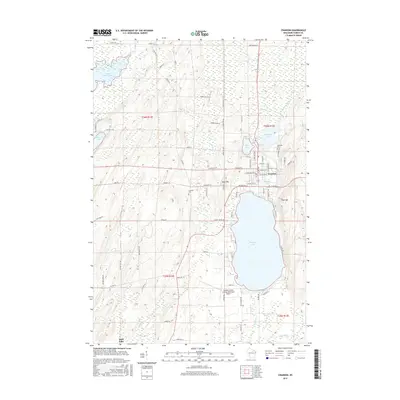
2015 Map of Crandon
USGS Topo · Published 2015About this map
Crandon serves as the focal point of this northern Wisconsin landscape, situated between the expansive Metonga Lake and the smaller Peshtigo Lake. The town's grid of streets, including N Railroad Ave and W Glen St, reflects a history intertwined with the Northwoods timber and rail economy. To the north, the Wolf River and Little Rice Lake mark the transition into a terrain defined by glacial remains, including West Hill and East Hill. Researchers can identify specific local landmarks such as Lakeside Cem and Crandon Cem, alongside modern infrastructure like the Crandon/Steve Conway Municipal Airport. The drainage patterns are clearly visible through the winding courses of N Br Peshtigo River and Outlet Cr, which navigate the various wetlands and upland elevations that characterize Forest County.
Find a feature on this map
85 named features on this map. Tap any name to fly to it.
Don’t see what you’re looking for? This feature index may not catch every label — zoom into the map to look around manually.
Map Details
Editions of this 2015 Crandon Map
This is the sole edition of this map. No revisions or reprints were ever made.
Other maps of this area

1939 · Crandon
USGS Topo · 1:48,000

1940 · Monico
USGS Topo · 1:48,000

1941 · Crandon
USGS Topo · 1:48,000

1942 · Elcho
USGS Topo · 1:48,000

1942 · Pearson
USGS Topo · 1:48,000

1947 · Crandon
USGS Topo · 1:48,000

1950 · Monico
USGS Topo · 1:48,000

1950 · Elcho
USGS Topo · 1:48,000

1950 · Lily
USGS Topo · 1:48,000

1954 · Iron Mountain
USGS Topo · 1:250,000