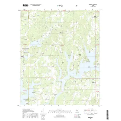
2018 Map of Crane Hill
USGS Topo · Published 2018About this map
Lewis Smith Lake dominates the southern half of this landscape, its fingers reaching into the hilly terrain of western Cullman County. The shoreline is defined by prominent points and ridges, such as Muscadine Point, Pea Ridge, and Calvert Point, reflecting a landscape transformed by the impoundment of the Black Warrior River's tributaries. Inland, the community of Crane Hill sits near Mount Hope Cem, while the smaller settlement of Trade occupies the western heights above Little Crooked Cr. To the west, the boundary of the William B. Bankhead National Forest marks a transition into protected woodlands.
Find a feature on this map
153 named features on this map. Tap any name to fly to it.
Don’t see what you’re looking for? This feature index may not catch every label — zoom into the map to look around manually.
Map Details
Editions of this 2018 Crane Hill Map
This is the sole edition of this map. No revisions or reprints were ever made.
Other maps of this area

1888 · Cullman
USGS Topo · 1:125,000

1889 · Birmingham
USGS Topo · 1:125,000

1892 · Cullman
USGS Topo · 1:125,000

1892 · Birmingham
USGS Topo · 1:125,000

1893 · Jasper
USGS Topo · 1:125,000

1895 · Birmingham
USGS Topo · 1:125,000

1907 · Birmingham
USGS Topo · 1:125,000

1949 · Cold Springs
USGS Topo · 1:24,000

1949 · Sunlight
USGS Topo · 1:24,000

1951 · Cold Springs
USGS Topo · 1:24,000