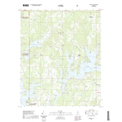
2021 Map of Crane Hill
USGS Topo · Published 2021About this map
Lewis Smith Lake dominates the central landscape of this Alabama quadrangle, its winding fingers creating complex shorelines that define modern-day Crane Hill and Sulphur Springs. The inundation of the Black Warrior River's Sipsey Fork and tributaries like Crooked Creek fundamentally altered the local topography, isolating former high ground into peninsulas such as Pea Ridge, Muscadine Point, and Calvert Point.
Find a feature on this map
145 named features on this map. Tap any name to fly to it.
Don’t see what you’re looking for? This feature index may not catch every label — zoom into the map to look around manually.
Map Details
Editions of this 2021 Crane Hill Map
This is the sole edition of this map. No revisions or reprints were ever made.
Other maps of this area

1888 · Cullman
USGS Topo · 1:125,000

1889 · Birmingham
USGS Topo · 1:125,000

1892 · Cullman
USGS Topo · 1:125,000

1892 · Birmingham
USGS Topo · 1:125,000

1893 · Jasper
USGS Topo · 1:125,000

1895 · Birmingham
USGS Topo · 1:125,000

1907 · Birmingham
USGS Topo · 1:125,000

1949 · Cold Springs
USGS Topo · 1:24,000

1949 · Sunlight
USGS Topo · 1:24,000

1951 · Cold Springs
USGS Topo · 1:24,000