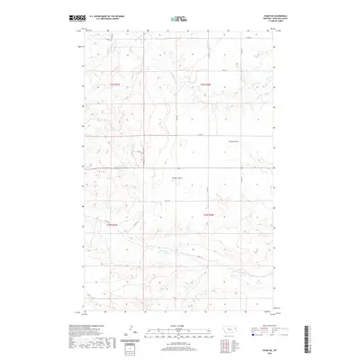
2020 Map of Crane NE
USGS Topo · Published 2020About this map
Lone Tree Creek and its South Fork carve a dendritic drainage pattern across this high plains landscape in Richland County. The terrain is defined by a network of seasonal coulees, including Spring Coulee and Youngs Coulee, which flow toward the more prominent Fox Creek system in the southern reaches of the quadrangle. This 2020 topographic study illustrates the vast rural character of eastern Montana, where the primary human footprint consists of a grid of county roads such as Co RD 127 and Co RD 345. The land is divided into large rectangular sections following the Public Land Survey System, as evidenced by the township boundaries of t23n r58e and t22n r58e. The intricate contour lines reveal the subtle elevation changes of the North Fork Fox Creek basin, providing a detailed record of the natural watershed before it joins the larger regional river systems.
Find a feature on this map
21 named features on this map. Tap any name to fly to it.
Don’t see what you’re looking for? This feature index may not catch every label — zoom into the map to look around manually.
Map Details
Editions of this 2020 Crane NE Map
This is the sole edition of this map. No revisions or reprints were ever made.
Other maps of this area

1909 · Glendive
USGS Topo · 1:250,000

1954 · Glendive
USGS Topo · 1:250,000

1957 · Glendive
USGS Topo · 1:250,000

1958 · Glendive
USGS Topo · 1:250,000

1966 · Crane NE
USGS Topo · 1:24,000

1966 · Crane NW
USGS Topo · 1:24,000

1966 · Piche
USGS Topo · 1:24,000

1966 · Crane
USGS Topo · 1:24,000

1966 · Sidney
USGS Topo · 1:24,000

1966 · Larson School
USGS Topo · 1:24,000