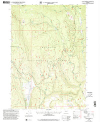
1999 Map of Crane Prairie
USGS Topo · Published 2002About this map
Malheur National Forest encompasses this high-elevation landscape of the Blue Mountains, where the headwaters of the North Fork Malheur River emerge from steep canyons and high ridges. By the late twentieth century, the area had been developed into a recreational corridor, evidenced by the presence of Elk Creek Campground, North Fork Malheur Campground, and Little Crane Campground. The map reveals a complex hydraulic network of named springs, including Hankins Spring, Winegar Spring, and Roaring Spring, which sustain the various forks and creeks that carve through the timbered terrain. Notable topographic landmarks such as Summit Rock and Sheep Mountain define the northern horizons, while the southern reaches descend toward Crane Prairie. Small-scale industrial activity is represented by a Quarry and a Gravel Pit, providing a grounded record of local resource management within the forest boundaries during this era.
Find a feature on this map
36 named features on this map. Tap any name to fly to it.
Don’t see what you’re looking for? This feature index may not catch every label — zoom into the map to look around manually.
Map Details
Editions of this 1999 Crane Prairie Map
This is the sole edition of this map. No revisions or reprints were ever made.
Other maps of this area

1908 · Ironside Mountain
USGS Topo · 1:125,000

1955 · Canyon City
USGS Topo · 1:250,000

1959 · Canyon City
USGS Topo · 1:250,000

1959 · Prairie City
USGS Topo · 1:62,500

1961 · Logan Valley
USGS Topo · 1:62,500

1970 · Flag Prairie
USGS Topo · 1:62,500
1972 · Bullrun Rock
USGS Topo · 1:24,000
1972 · Little Baldy Mnt.
USGS Topo · 1:24,000

1978 · John Day
USGS Topo · 1:100,000
1988 · Logan Valley East
USGS Topo · 1:24,000