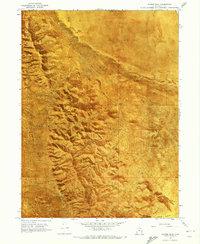
1968 Map of Craner Peak
USGS Topo · Published 1973About this map
The Lakeside Mountains and the arid expanse of Lakeside Valley define this 1968 orthophotomap near the border of Box Elder and Tooele counties. The landscape is marked by the distinct tracks of a Jeep Trail winding through rugged canyons and past high points like Jedediah Mtn and Craner Peak. Industrial and ranching history is evident in the presence of the Marblehead Quarry and the Monarch Mine, while the scattered wells—including the Old Wrathall Well (Site) and Johnson Well—illustrate the critical importance of water management in this desert environment. The use of an orthophotomosaic base provides a rare perspective of the native vegetation and geology as it appeared during the late 1960s, showing the precise relationship between narrow mountain passes like Beards Hollow and the expansive Mud Flat.
Find a feature on this map
24 named features on this map. Tap any name to fly to it.
Don’t see what you’re looking for? This feature index may not catch every label — zoom into the map to look around manually.
Map Details
Editions of this 1968 Craner Peak Map
2 editions found

Other maps of this area

1885 · Tooele Valley
USGS Topo · 1:250,000

1953 · Tooele
USGS Topo · 1:250,000

1954 · Brigham City
USGS Topo · 1:250,000

1955 · Tooele
USGS Topo · 1:250,000

1958 · Brigham City
USGS Topo · 1:250,000

1962 · Brigham City
USGS Topo · 1:250,000

1968 · Carrington Island SW
USGS Topo · 1:24,000

1968 · Poverty Point
USGS Topo · 1:24,000

1968 · Deardens Knoll
USGS Topo · 1:24,000

1968 · Badger Island NW
USGS Topo · 1:24,000