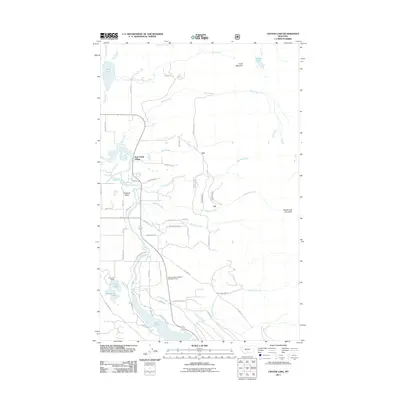
2011 Map of Crater Lake
USGS Topo · Published 2011About this map
Bear Creek Village serves as a central point of habitation in this pocket of the Flathead Valley, where residential development meets the steep slopes of Crater Mountain and Broken Leg Mountain. The landscape is defined by the complex hydrology of the Swan River and its numerous tributaries, including Peterson Creek, Patterson Creek, and Meadow Creek. To the south, the waters of Swan Lake are preceded by smaller basins such as Loon Lake and Horseshoe Lake, illustrating the post-glacial topography of the region.
Find a feature on this map
57 named features on this map. Tap any name to fly to it.
Don’t see what you’re looking for? This feature index may not catch every label — zoom into the map to look around manually.
Map Details
Editions of this 2011 Crater Lake Map
This is the sole edition of this map. No revisions or reprints were ever made.
Other maps of this area

1914 · Nyack
USGS Topo · 1:125,000

1920 · Flathead Lake
USGS Topo · 1:125,000

1943 · Kalispell
USGS Topo · 1:125,000

1955 · Choteau
USGS Topo · 1:250,000

1956 · Wallace
USGS Topo · 1:250,000

1957 · Choteau
USGS Topo · 1:250,000

1957 · Kalispell
USGS Topo · 1:250,000

1958 · Choteau
USGS Topo · 1:250,000

1960 · Kalispell
USGS Topo · 1:250,000

1960 · Wallace
USGS Topo · 1:250,000