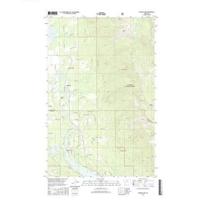
2017 Map of Crater Lake
USGS Topo · Published 2017About this map
Swan River winds through the heart of this landscape, marking the transition between the developed residential pockets of the Flathead Valley and the steep, timbered slopes of the Flathead National Forest. This 2017 survey shows the area around Bigfork during a period of modern growth, with a dense network of local roads such as Slethaug Ln and Wolf Creek Dr intersecting with older routes like Old Winchester Rd.
Find a feature on this map
87 named features on this map. Tap any name to fly to it.
Don’t see what you’re looking for? This feature index may not catch every label — zoom into the map to look around manually.
Map Details
Editions of this 2017 Crater Lake Map
This is the sole edition of this map. No revisions or reprints were ever made.
Other maps of this area

1914 · Nyack
USGS Topo · 1:125,000

1920 · Flathead Lake
USGS Topo · 1:125,000

1943 · Kalispell
USGS Topo · 1:125,000

1955 · Choteau
USGS Topo · 1:250,000

1956 · Wallace
USGS Topo · 1:250,000

1957 · Choteau
USGS Topo · 1:250,000

1957 · Kalispell
USGS Topo · 1:250,000

1958 · Choteau
USGS Topo · 1:250,000

1960 · Kalispell
USGS Topo · 1:250,000

1960 · Wallace
USGS Topo · 1:250,000